
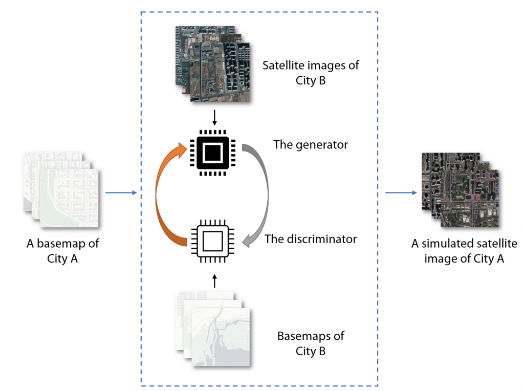
False satellite images created by machine learning raise concerns about the reliability of data
AI technologies has been used to created false satellite images and the phenomenon of “deepfake geography” will eventually affect the quality of geospatial analysis. The location spoofing begins with machine learning algorithm which learns the characteristics of urban features from satellite images, after that these characteristics can be applied to different base maps. When there are enough training samples, the AI can create various versions of fake images for the same interest area. This issue brings out the urge for the geomatics community to review the reliability of satellite images, in order to develop data literacy tools for public benefit.
Article can be viewed here.
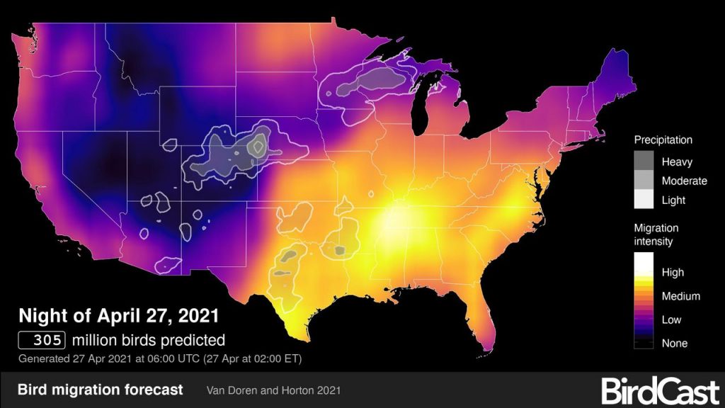
BirdCast map helps bird lovers to spot bird migration
Michigan is expected to have a huge influx of birds this week for this year’s migration season. The nocturnal bird migration process is correlated with the winds blowing up from the Southern part of the United States. The bird migration status is updated by local weather surveillance radar, and the real-time analysis maps are created to help guide birdwatching activities. Everyone is welcomed to report any birding hotspot at eBird.org.
Article can be viewed here.
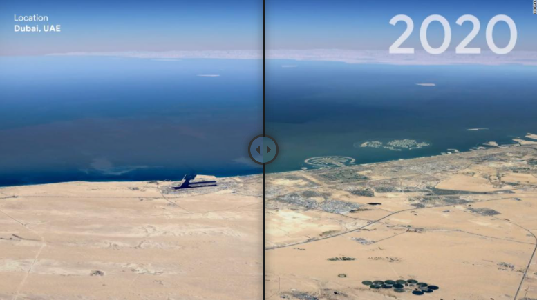
Google Timelapse video visualizes footprint of human activities
Google Timelapse is a new feature which visualizes how urban development and climate change have reshaped the Earth’s surface. The dynamic 4D effect highlights the loss of ice sheets, urban sprawl and expansion of the agriculture industry. Most of the satellite images are contributed by NASA, the Landsat program from the United States Geological Survey, and the Sentinel satellites from the European Union’s Copernicus program. Governments, researches and journalists are encouraged to analyze the images and find out potential threats towards humanity and the ecosystem.
Article can be viewed here.
Remote Sensing technology is used to track chimpanzes
Remote sensing technology, especially LiDAR, is used with machine learning approaches to understand and map the habitats of chimpanzees in the Tchimpounga Nature Reserve. Chimpanzees are listed as an endangered species and scientists are looking for solutions to accelerate their conservation impact. Their latest project involves using LiDAR and algorithms to identify structural features such as their nests and the chimpanzees themselves. The laser scanner can be mounted on a drone, aircraft, tripod or backpack. The observed data will then be integrated with satellite images to create a monitoring system in the future.
Article can be viewed here.
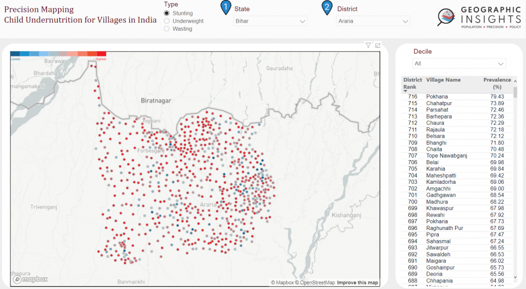
Mapping childhood undernutrition in rural India villages
The issue of childhood undernutrition is critical among villages in India. The Havard T.H. Chan School of Public Health has mapped about 600,000 villages in rural area to record health indicators and develop tailor-made policies to those who are affected by specific health issues. The project aims to create the data set at a large village scale which has not been observed before. The finding shows that there is a huge variation of childhood health issues across different villages. For example, the average predicted rate of stunting was 5% in some villages but exceeded 70% in other villages. The research team hopes that such data can help public health officials better prioritize villages.
Article can be viewed here.


Be the first to comment