1. Climate change is making lakes less blue
2. Next Gen Unicore Communications GNSS available through Rx Networks
3. Participatory Mapping Enhances Coordination of USAID Projects in Nepal
4. Here’s What it Looks Like Inside Hurricane Fiona
5. Thought for Food: Accurate Data to Feed 8 Billion
Climate change is making lakes less blue

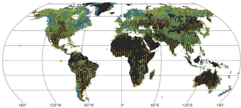
According to research published in Geophysical Research Letters, if global warming is not stopped, blue lakes around the world will be at risk of turning green-brown. These colour shifts, can indicate ecosystem health degradation. It is known that algae and sediment affect lake colour, however in this study, it points out that air temperature, precipitation, lake depth, and elevation factor into the colour.
View this interactive map to see lake colour across the globe.
Also, read the full article here.
Next Gen Unicore Communications GNSS available through Rx Networks
Rx Networks has recently announced the release of Unicore’s next generation of high-precision GNSS modules. This new generation offers all constellation and multi frequency high precision RTK positioning and heading. These modules are affordable, small, and low power consumption. Applications include drones, robotics, machine control, surveying/mapping, and many more.
Read the full article here.
Participatory Mapping Enhances Coordination of USAID Projects in Nepal

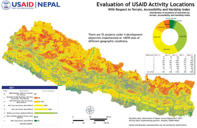
For years, USAID has been working with Nepal to design and execute development programs. These programs have be indicated by the government of Nepal and include sector like health, emergency response, disaster relief, education, etc. Because there are so many activities going on with this project, there needs to be a way to implement, monitor, and analyze the outcomes, simply. ArcGIS Online is relied upon for its ease of use and simplicity when it comes to participatory mapping systems. ArcGIS Online allows for all geospatial data collected to be properly collected, stored manipulated, and analyzed. In the future, there are hopes this model can be transferred to other missions around the world.
Read the full article here.
Here’s What it Looks Like Inside Hurricane Fiona
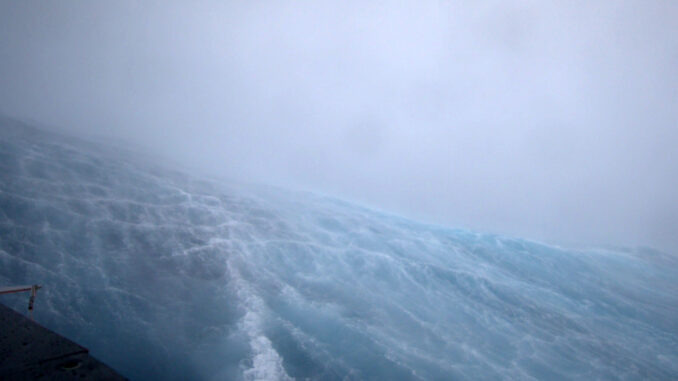
The footage above of Hurricane Fiona was captured by Saildrone’s SD 1078 unamend surface vessel. This was taken on September 22, 2022 in the Atlantic ocean, and depicts 100 mph winds and 50 foot waves. NOAA and Saildrone have partnered and have multiple other unmanned vessels stationed throughout the Gulf of Mexico/Atlantic Ocean to capture data for hurricanes and help us gain a better understanding of them.
Read the full article here.
Thought for Food: Accurate Data to Feed 8 Billion

A couple weeks ago, nations across the world issues an appeal to private industry and organizations to help collaborate and respond to food security for billions of people. Today global food security is at an critical point, and according to the 2022 Global Report on Food Crises, 55 countries are in dire need of assistance and 36 countries are close to famine. COVID-19, supply chain issues, climate change related events, and conflicts have had an immensely negative impact on food production and supplies. In order to overcome these challenges, collaboration is needed as well as implementation of a science based approach to climate resilient agricultural advancements.
Read the full article here.


Be the first to comment