
Interactive Map Shows the Best Time to Photograph Fall Foliage
Photographers will not have difficulty planning fall photoshoots anymore and can easily choose optimal shooting days with this interactive fall foliage prediction map that shows when the leaves of each region will be the most colourful. The map provides a weekly visual planning guide showing changes in foliage across the United States, starting from August 30 to November 15, where one can see when leaves are still green with “No Change” to “Past Peak” with leaves falling.
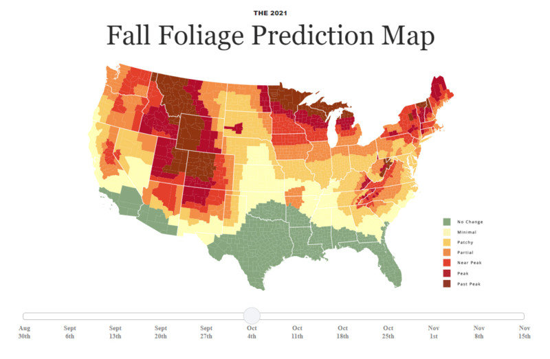
Interactive Map Shows the Best Time to Photograph Fall Foliage | PetaPixel
New interactive 3D map lets you see downtown Tampa in a new way
Tampa Bay launched a 3D interactive map that is the first of its kind and a great platform for tourists. The map comprises downtown Tampa’s most iconic landmarks – the convention center, riverwalk, Sparkman Wharf and the Glazer Children’s Museum, shown in a 360-degree view. The map is integral for the understanding of Tampa Bay’s scope, walkability and offerings.

New interactive 3D map lets you see downtown Tampa in a new way (abcactionnews.com)
Downtown Tampa Interactive Map (visittampabay.com)
Geospatial Commission launches pilots to improve how data about land is used in the UK
The UK has a target to reduce net-zero greenhouse gas emissions, construct affordable and sustainable homes, and dedicate £600 billion of infrastructure investment to Build Back Better. For the sustainable usage of land area, the Geospatial Commission has set key priorities and is looking into investing £4.56 million with pilot area partners in Devon, West Midlands and Northern Ireland. They are aiming to retrieve blueprints for improving land use data, overcoming data access challenges, and evaluating the benefits of using a common UK-wide platform for accessing land use data.
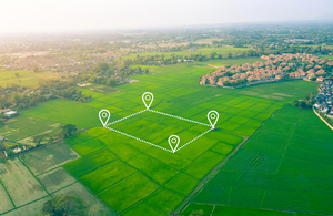
Lets Drop a Raindrop on This Magical Map and Watch Its Journey to the Ocean
Join a raindrop on its journey to the ocean with an interactive map called River Runner. Watershed data attained from the United States Geological Survey (USGS), allows the map users to “drop” a raindrop and trace its path anywhere within the contiguous United States. The viewers do not just see a 2D view of the path but instead, sees the animated journey through mountains, fields and watersheds from the raindrop’s perspective, with the help of a Mapbox map and 3D elevation data.
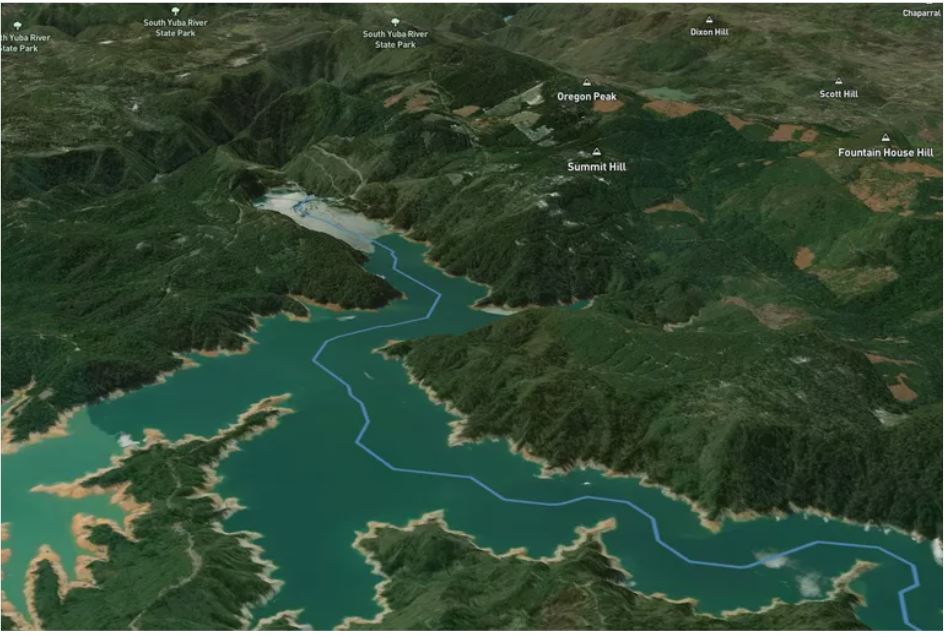
Drop a Raindrop on This Magical Map and Watch Its Journey to the Ocean (treehugger.com)
FireWatch maps aim to help keep homes, community safe from wildfire
FireWatch, in partnership with Rancho Santa Fe Association, is utilizing aerial imaging to provide residents with a new tool to help create defensible space zones around their homes, which will slow the spread of wildfire and protect their lives and property. The Rancho Santa Fe Association is sending defensible space maps to every homeowner within the Covenant. FireWatch maps will also increase the insurability of houses and properties since Covenant residents have previously noticed their insurance policies dropping due to greater fire risk.
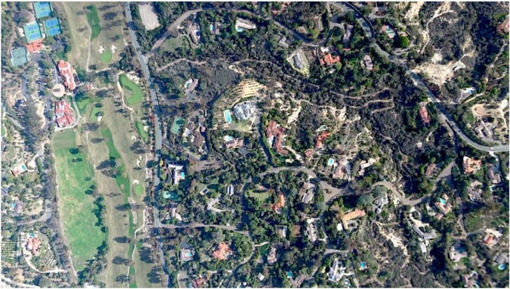
FireWatch maps aim to help keep homes, community safe from wildfire – Rancho Santa Fe Review
PowerPoint Presentation (rsfassociation.org)
Geospatial Data Essential to Protect Snow Leopard in Mongolia
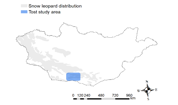
Intermap, highly recognized globally for geospatial content development and intelligence solutions, in collaboration with The Snow Leopard Trust, is providing high-resolution elevation models to scientists for aiding the conservation of snow leopards in Mongolia. Research on the leopard species’ behaviour is being carried out to understand snow leopard ecology, their usage of the mountainous terrain, in order to conserve the species. Intermap is providing 3D digital elevation models (DEMs) in Southern Mongolia to support this conservation project.



Be the first to comment