- A Map That Visualizes Walkable Neighborhoods Across the US
- Transforming Retail with Location-Based Insights and Geo-marketing
- Open Buildings: AI-powered maps for a changing world
- First-ever interagency sea level rise website is live
- Maps reveal how climate change could redraw national borders, depending on the success of United Nations-led negotiations
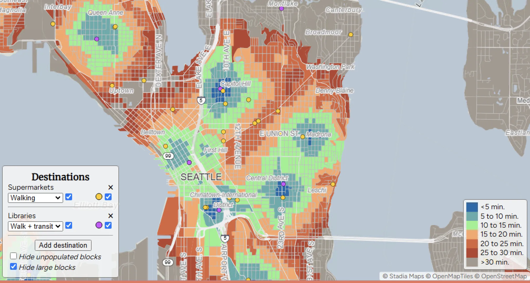
A Map That Visualizes Walkable Neighborhoods Across the US


“Close” is an interactive map created by geographer Nat Henry to check how walkable neighbourhoods across the U.S. are. It started as a way to see how walkable Seattle was, but the map became so popular that it was expanded nationwide. People can use it to see how close they are to grocery stores, parks, and schools, and whether their area is good for biking or public transit. It’s widely used for finding places to live or for city planning, showing that walkable communities are important to people.
Transforming Retail with Location-Based Insights and Geo-marketing
Retailers are using location data and geo-marketing to improve their business. They analyze where customers are and how they shop. Stores can send personalized offers based on location. They can also choose better locations for new stores. This helps them manage inventory more efficiently. The goal is to target customers better and increase sales. Technologies like geofencing, beacons, and predictive analytics help make this possible. Retail is becoming smarter and more efficient with these tools.
Open Buildings: AI-powered maps for a changing world

Google’s Open Buildings project uses AI to map buildings globally, helping with urban planning and service distribution. The newly released 2.5D Temporal Dataset includes building locations and heights from 2016 to 2023. This data helps governments, aid organizations, and researchers in areas with limited resources make better decisions, such as planning infrastructure and estimating population sizes. While effective, challenges like cloud cover and detecting small buildings may affect data accuracy. Overall, this AI tool supports smarter urban planning and inclusive decision-making.
First-ever interagency sea level rise website is live

The U.S. Interagency Task Force on Sea Level Change has launched SeaLevel.GlobalChange.gov, the first comprehensive, government-wide online resource on sea level rise. The website offers the latest research on sea level changes, educational materials on its causes and impacts, and actions to address coastal community challenges. It aims to improve public access to critical data, helping local communities strengthen their resilience to climate change. NOAA Administrator Rick Spinrad highlighted the importance of the site in connecting scientific data with real-time decision-making.
Maps reveal how climate change could redraw national borders, depending on the success of United Nations-led negotiations

Climate Central has created a new map that shows how climate change could reshape coastlines around the world. Scientists and climate experts are calling for a limit on how much the sea can rise to help protect low-lying countries and coastal cities. If carbon emissions continue unchecked, sea levels could rise by up to three meters by the end of this century, affecting 550 million people. But by cutting emissions, the rise could be limited to just one meter, saving more land. While the 1.5°C goal from the Paris Agreement remains important, experts believe setting a clear sea level rise limit could drive faster climate action.


Be the first to comment