
- Google Working with Partners to Build Wildfire-Spotting Satellite Constellation
- US Considers Cutting Program Charged with Monitoring Satellite Traffic
- Europe Launches its First Geostationary Satellite
- MethaneSat Goes Silent After One Year
- Visitors Can View Historic Maps of Film Sites Around Los Angeles
- US Military is Cutting Researchers Off from Key Sea Ice Data
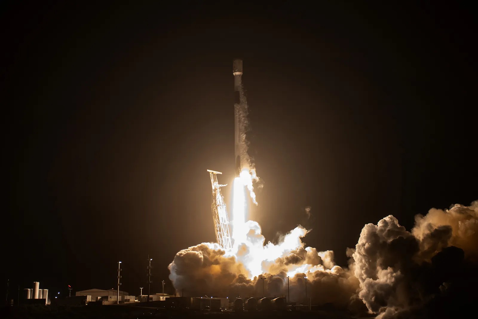
Google Working with Partners to Build Wildfire-Spotting Satellite Constellation
Google has joined with the nonprofit Earth Fire Alliance and satellite manufacturer Muon Spato to develop the constellation FireSat, which is tasked with monitoring wildfires on the Earth’s surface in real-time. Once the full set of 52 satellites are in orbit – which is expected by 2029 – the constellation will be able to spot wildfires as small as 10 square metres and check on any given location every 20 minutes. By combining a complex dual camera system with machine learning, FireSat will be able to spot very small wildfires, which have historically been challenging to locate via satellite imagery. The first satellite in the FireSat constellation was launched earlier this year.
Learn more here:
US Considers Cutting Program Charged with Monitoring Satellite Traffic
More than 400 companies, including SpaceX and Amazon, have called on Congress to end their plan for cancelling NOAA’s Traffic Coordination for Space (TraCSS) program. TraCSS was created during the first Trump Administration, during which time NOAA assumed responsibility for a satellite program previously overseen by the Pentagon. TraCSS has proved crucial to helping satellite operators avoid collisions in space – an important challenge, as there are currently 12000 active satellites in orbit, along with a variety of space junk and old satellites.
Learn more here:
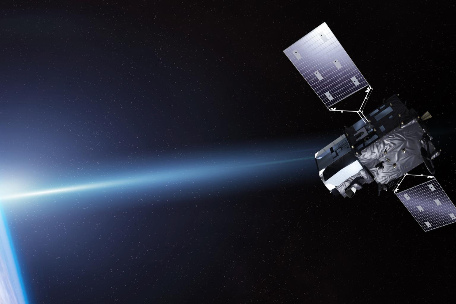
Europe Launches its First Geostationary Satellite
The European Organization for the Exploitation of Meteorological Satellites (EUMETSAT) launched MTG-S1, a crucial tool for monitoring weather and hosting the European Space Agency’s Sentinel-4 mission, On July 1. Using an infrared sounder, MTG-S1 is able to produce 3-dimensional maps of the atmosphere, highlighting data on temperature, humidity and trace gases. MTG-S1 is a powerful tool for forecasters, as will allow them spot severe weather earlier in its development. As the satellite is geostationary, it will only capture information about the atmosphere over Europe, Africa and surrounding regions.
Read more here:
MethaneSat Goes Silent After One Year
Contact was lost with the satellite MethaneSat, which was roughly one year into its five-year mission of tracking methane emitters. MethaneSat was launched in 2024 by the Environmental Defense Fund with backing from major tech industry players such as Jeff Bezos and Google. The data MethaneSat collected about methane emissions was crucial in the fight against climate change, as methane is a significant greenhouse gas.
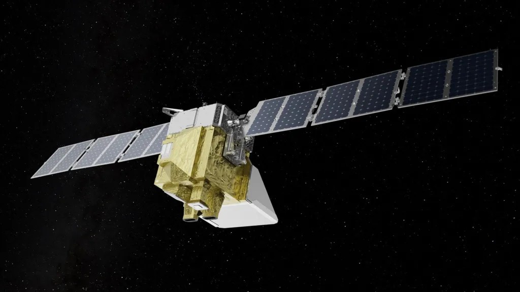
While the loss of MethaneSat is a major setback, it was not the only satellite tracking methane emissions. GHGSat is a Canadian company which designs and operates its own satellite constellation for tracking methane and other greenhouse gases. GHGSat currently has 12 satellites in orbit.
Read more about the loss of MethaneSat:
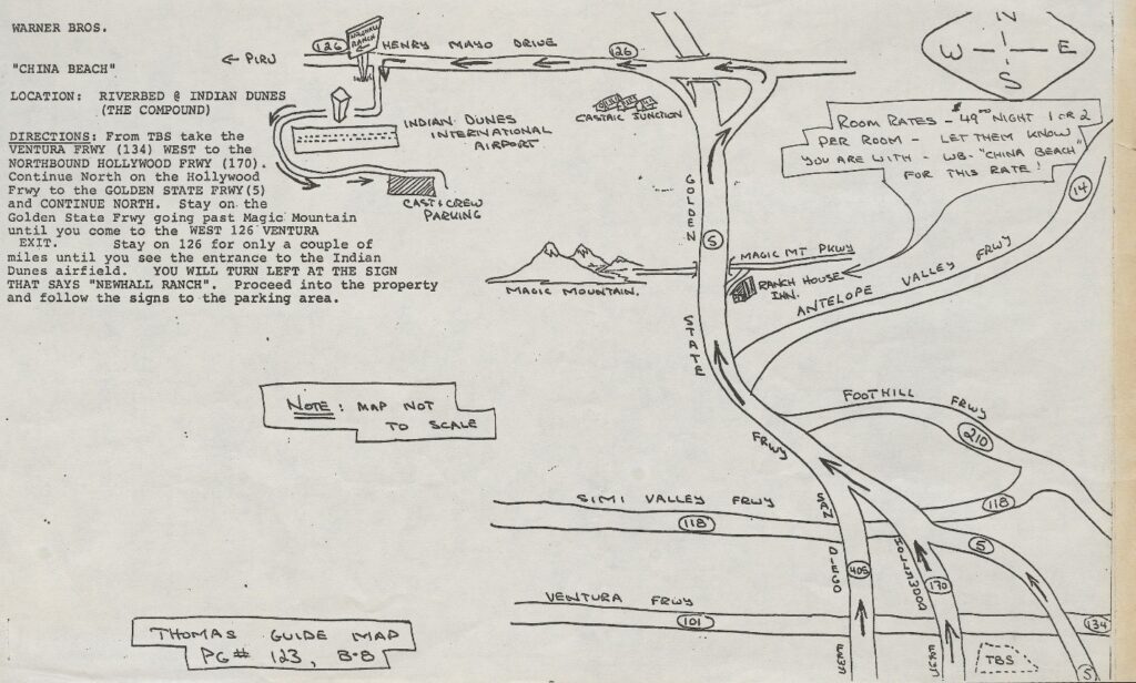
Visitors Can View Historic Maps of Film Sites Around Los Angeles
The Geography and Maps Division of the Library of Congress is currently hosting the Los Angeles filming location map collection, 1983 – 1987. This collection contains 280 images of hand drawn maps showing LA streets and neighbourhoods used in 56 production between 1983 and 1987. Viewers can see details including titles of production, filming dates and general navigation instructions. These images can be viewed within the Geography and Map Division Reading Room at the Library of Congress in Washington, D.C.
Learn more here:
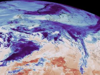
US Military is Cutting Researchers Off from Key Sea Ice Data
The US Department of Defense has announced it will cease real-time processing and sharing of its sea ice measurement data. This is a serious concern for organizations such as the National Snow and Ice Data Center (NSIDC) at the University of Colorado, Boulder, which utilizes data from the United States Air Force Defense Meteorological program. This data is important for measuring changes in Earth’s ice coverage and serves as a crucial tool for understanding the impacts of climate change on the planet.
Researchers at NSIDC are now considering switching over to data from the Japanese Aerospace Exploration Agency satellite Chizuku. It is likely that researchers will loss access to data for several months during this transition.
Read more here:

Be the first to comment