
- Planning Landmine clearances with UAV LiDAR
- Mapping pollution from space
- Tracking dangerous chemicals in the Great Lakes with maps
- New Google Maps API helps with mapping pollen, solar, and air quality.
- Understanding geospatial intelligence
Planning Landmine clearances with UAV LiDAR
In a recent case study conducted by a British mine-clearing charity, HALO Trust, 3 Angolan known conflict areas were mapped with UAV LiDAR. The primary objectives were to locate mines and plan for their eventual clearance. This expansive article highlights the equipment used, the unique processes involved, and the success factors for such an undertaking. In addition, it sheds light on the resolution of UAV LiDAR. Read More

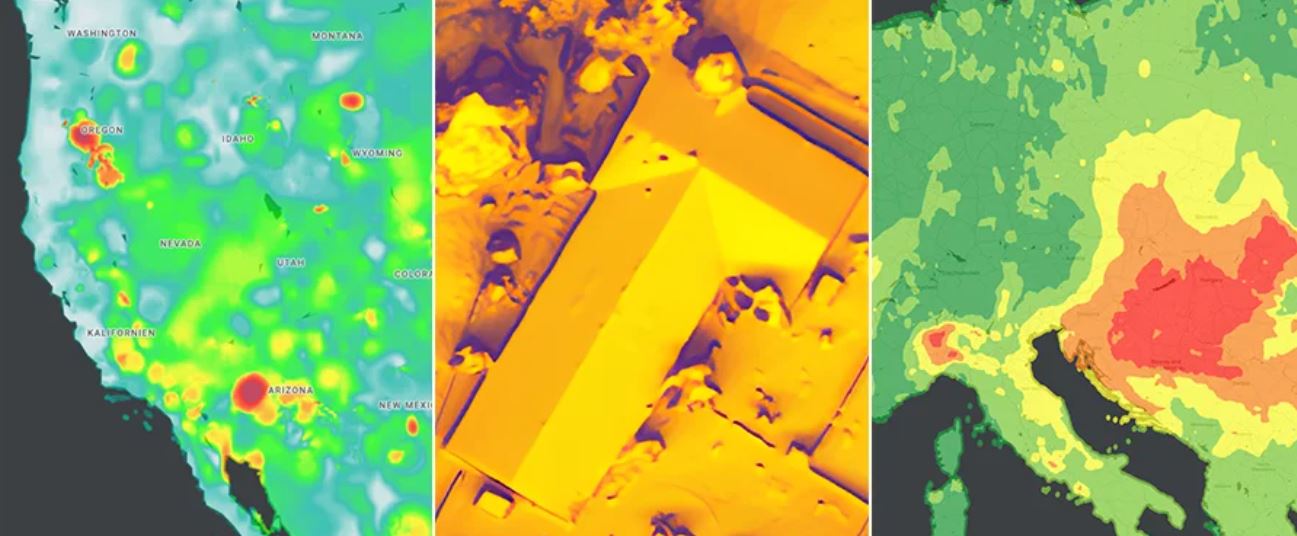
Mapping pollution from space
NASA has launched a new tool in the fight against climate change. Tropospheric Emissions: Monitoring of Pollution, or TEMPO is a light analyzer that measures air quality by measuring sunlight reflected off the surface of the earth, clouds, and atmosphere. With such a tool, NASA has been able to measure and map out air quality over major US, Canadian, Caribbean, and Mexican cities. Read More and check out the maps.

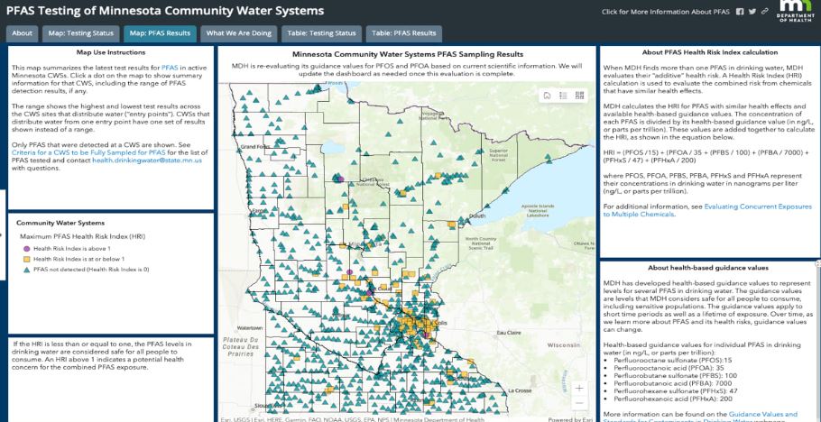
Tracking dangerous chemicals in the Great Lakes with maps
Since its introduction in the 1940s Polyfluoroalkyl substances (PFAS), have been a key ingredient in many products. This has led to their introduction into our water systems and has made their way into the Great Lakes. In a recent initiative by the Wisconsin Department of Natural Resources (DNR), water samples from around the state were taken and tested for PFAS and their results were recorded on a GIS platform. This enabled Wisconsin to educate the public, perform studies on drinking water, better plan remedy efforts, and track contamination. Read More.
New Google Maps API helps with mapping pollen, solar, and air quality
With climate change being a hot topic, Google has introduced 3 new APIs through the google maps platform to help build tools to map pollen, solar, and air quality. These have been built with a combination of AI, machine learning aerial imagery, and environment data. Read More and check out the platform.
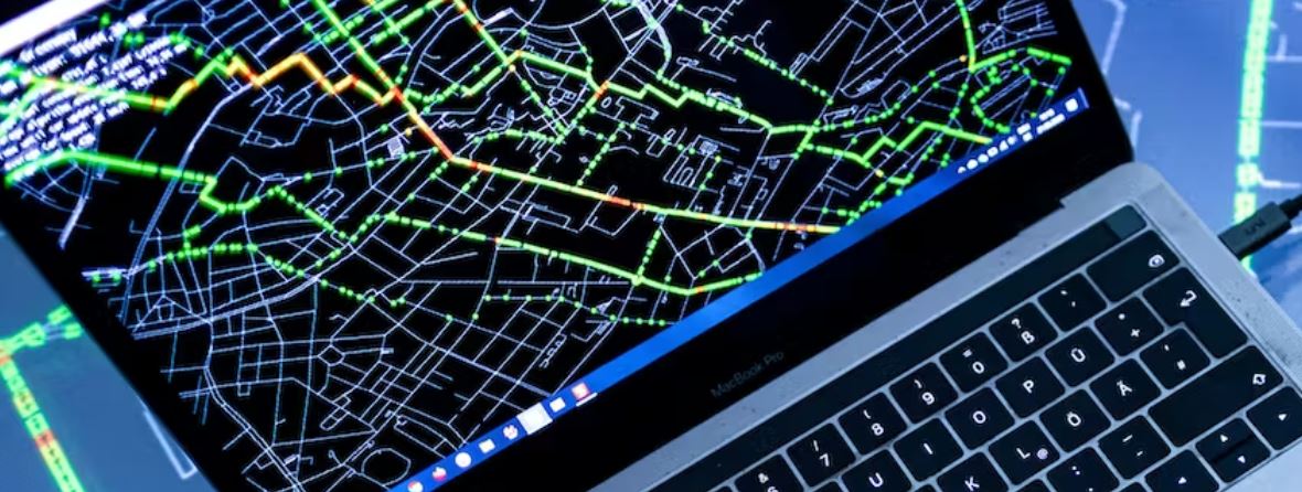
Understanding geospatial intelligence
With events around the world happening rapidly, decision-makers require actionable data. One such source is from the geospatial world. Some areas where geospatial intelligence is used are in disasters and logistics. Applications related to disasters include coordinating search and rescue efforts, monitoring hurricanes, tracking polar ice, and understanding temperature profiles. Logistics which can be either military or civilian include tracking enemy armies, coordinating supply chains, and leveraging digital twins. Read More


Be the first to comment