
- When the Government Can See Everything: Palantir’s Secretive Data Mapping Puts Civil Liberties at Risk
- Who Owns Canada’s Data? The Challenge of U.S. Cloud Control
- Does the Sky Belong to Us or Satellites?
- Hema Maps: Australia Indigenous Journey Map
- Tohono O’odham Community College Advances Cultural Preservation for Native American Tribes
- Saving Cultural Heritage Sites by Integrating Remote Sensing and Archaeological Knowledge
When the Government Can See Everything: Palantir’s Secretive Data Mapping Puts Civil Liberties at Risk
Palantir Technologies, a private data-analytics firm, has secured expansive contracts with the U.S. government—contracts whose details remain largely opaque to the public. Through its Gotham software platform, Palantir enables agencies to integrate and visualize vast streams of information, ranging from driving records and police reports to social media activity. This allows for unprecedented surveillance capabilities by mapping and continuously monitoring individuals and communities. The piece highlights growing concern over how this fusion of disparate data sources could reshape governance—tilting the balance between security and civil liberties in the long term. Read more here.
Who Owns Canada’s Data? The Challenge of U.S. Cloud Control Act
Canada defines data sovereignty as the right to control its digital information under Canadian law alone. Yet, under the U.S. CLOUD Act, companies like Microsoft are legally required to comply with U.S. government demands for data without needing permission or even notifying Canadian authorities.
In practice, this means U.S.-based tech giants such as Microsoft, Amazon, and Google can be compelled to hand over data to American agencies regardless of where that data is stored, whether through software, hardware, internet hosting, or other means. This poses a serious challenge for Canadians. Testimony from Microsoft France’s legal representative has confirmed that the CLOUD Act effectively overrides all international and domestic laws, raising major concerns about Canadian sovereignty and the security of sensitive government and defence data. Read more here.
Does the Sky Belong to Us or Satellites?
Alarms are growing over the rapid rise of satellite mega-constellations and their profound impact on astronomy. These densely packed networks are now increasingly visible in the night sky, leaving streaks and light pollution that overwhelm both optical and radio telescopes. Beyond the visual disruption, broadband transmissions and unintended electromagnetic noise from satellites interfere with highly sensitive surveys. For groundbreaking projects like the upcoming Vera Rubin Observatory, even a single satellite streak can compromise entire observations threatening our ability to study the universe. Read more here.

Tohono O’odham Community College Advances Cultural Preservation for Native American Tribes
Tohono O’odham Community College (TOCC) is addressing the needs of the Tohono O’odham Natural Resources Department (TONDNR) by offering associate’s degrees and micro-certificate programs, including a drone technology (UAV) certificate. These initiatives support tribal-led conservation and cultural preservation efforts across the Nation’s 2.8 million acres in the Sonoran Desert. By leveraging drone technology, TOCC is enhancing environmental stewardship and disaster preparedness while also preserving and transmitting cultural heritage. Equally important, ownership of the data collected by drones remains a foremost priority. Indigenous communities must retain control over who collects data, how it is used, and who has access to it requiring clear agreements and protocols that affirm the authority of tribal governments over their data. Read more here.
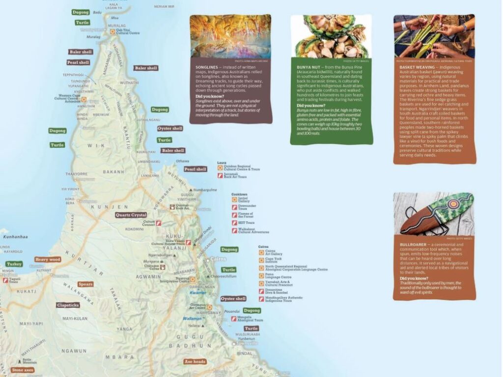
Hema Maps: Australia Indigenous Journey Map
Explorer and geologist James Allen, Craig Molyneux, the Hema Maps team, and several partner groups collaborated to bring to life the Australia Indigenous Journeys Map. Through extensive field research conducted between 2020 and 2024, they documented the vast networks of Songlines, trade routes, and cultural pathways that predate European colonization.
This remarkable geographic work serves as both a representation of memory, culture, and legacy, and a rare visualization of Australia’s landscape before colonization. Featuring more than 250 Indigenous language group names, the map offers travelers a unique perspective on Australia’s history and geography, while highlighting the deep and enduring connection between the land and its Traditional Owners. Read more here.
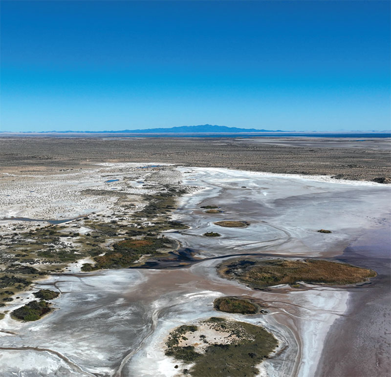
Saving Cultural Heritage Sites by Integrating Remote Sensing and Archaeological Knowledge
To address the rapid coastline shifts in Kenya, Tanzania, and Senegal, geospatial scientist Dr. Pamela Ochungo and her team are combining archaeology with satellite science. They have created a new digital dataset that maps archaeological sites along these vulnerable coasts and uses advanced remote sensing to track how changing shoreline patterns intersect with and threaten these heritage locations. Read more here.


Be the first to comment