• facebook
  • Twitter
  • Linkedin
  • Youtube
  • Linkedin Group
  • Post a Job
  • Post an Ad
  • Post an Event
  • Post a Directory Listing
  • Post a Press Release
  • Media Kit
  • My Account
  • Login
GoGeomatics
  • MAGAZINE
    • BIM & GIS
    • Community
    • Conference news
    • Earth Observation
    • Education & Careers
    • GEOAI
    • Announcements
    • Reality Capture & Lidar
    • Science
    • Technology
    • Between the Poles
  • Directories
    • ASSOCIATION
    • INDUSTRY
    • EDUCATION
    • Open Data
  • EVENTS
    • GeoIgnite Events
    • Events Calendar
    • GoGeomatics Meetups
  • Services
    • Advertising
    • Marketing
    • Post a Job
    • Post an Ad
    • Post an Event
    • Post a Press Release
    • Post a Directory Listing
    • Media Kit
    • Web Design
  • Find a Job
  • Volunteer
    • Start a GoGeomatics Group
    • Editors & Writers Group
  • About Us
    • About Us
    • Contact Us
    • Frequently Asked Questions
  • Videos
HomeBetween the Poles – The Geoff Zeiss Archives3D data

3D data

No Picture
3D data

City regulation reduces underground utility damage during excavations

20 May 2019 Geoff Zeiss

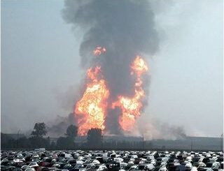
Every year there are 400,000 incidents of damage to underground utilities during excavation in the U.S.  This is a world wide problem but some jurisdictions have found ways to reduce the number of underground utility […]

3D data

National underground infrastructure map could deliver £245 million per year to UK

2 May 2019 Geoff Zeiss

The Geospatial Commission’s Annual Plan 2019/20 describes the activities that it plans to undertake in 2019/2020 to develop the UK’s National Geospatial Strategy.  The first project announced for 2019/2020 is its intention to fund two […]

3D data

Role of surveyors in digitally mapping underground utilities

1 May 2019 Geoff Zeiss
3D data

British standard PAS128 for underground utility location to be updated

24 April 2019 Geoff Zeiss

Belgium underground gas line explosion during excavation 2003 As we are reminded by the recent underground utility hits in San Francisco, CA, Durham, NC, and Calgary, Alberta, not knowing the location underground utilities represents a […]

No Picture
3D data

First international workshop on digitally mapping the underground

9 April 2019 Geoff Zeiss

At Geospatial World Forum 2019 the first international workshop on digitally mapping the underground Underground mapping for resilient infrastructure: Datafication of the Underground was organized by Rob van de Velde and Paul Janssen of Geonovum.  […]

3D data

Automating transmission line inspections with BVLOS drones and machine learning

2 April 2019 Geoff Zeiss

Transmission line inspections for vegetation management and other purposes are essential in ensuring grid reliability and resilence.  They are generally performed by manned helicopters or by a ground crew.  Data is collected with cameras and […]

3D data

Urgent: Standards-based geospatial + BIM interoperability requires broad vendor participation

29 March 2019 Geoff Zeiss

At the International Standards Summit 2019 in Düsseldorf a group of people representing owners, engineering and construction firms, vendors and services providers in the AEC space, and standards organization Open Geospatial Consortium (OGC) and buildingSMART […]

3D data

Automating vegetation management for electric power transmission lines using deep learning with LIDAR

26 February 2019 Geoff Zeiss

With FAA rules permitting beyond visual line of sight (BVLOS) UAVs available through Part 107 waivers the cost of capturing the data required for vegetation management for power lines, whether transmission or distribution, could drop […]

Posts pagination

« 1 … 9 10 11 … 30 »

Events

Notice
There are no upcoming events.

View All Events

Services

  • Post a Job
  • Post an Ad
  • Post an Event
  • Post a Directory Listing
  • Post a Press Release
  • Media Kit
  • My Account
  • Login

Jobs

Post a Job
  • Volunteer Editorial Contributor – Be Part of Canada’s Geomatics Story
    Remote
  • Junior Geomatics Field Technician – Technical Surveys
    Montréal, QC
  • GIS Specialist
    Amherst, Nova Scotia
  • Precast Structural BIM Specialist
    Calgary, Alberta
View All Jobs
  • Directories
    • Associations Directory
    • Industry Directory
    • Education Programs
    • Open Data
  • Volunteer
    • Start a GoGeomatics Group
    • Editors & Writers Group
  • About Us
    • GoGeomatics Media Kit
    • Who We Are
    • Contact Us
    • FAQ’s
    • Advertising
    • Marketing
  • Subscribe
GoGeomatics
GoGeomatics is the largest and most popular communications hub promoting the Canadian geospatial community. The business was incorporated in 2011. GoGeomatics hosts over 100 fun, free, location technology networking events each year in cities across Canada.

© 2026 GoGeomatics

  • facebook
  • Twitter
  • Linkedin
  • Youtube
  • Linkedin Group