• facebook
  • Twitter
  • Linkedin
  • Youtube
  • Linkedin Group
  • Post a Job
  • Post an Ad
  • Post an Event
  • Post a Directory Listing
  • Post a Press Release
  • Media Kit
  • My Account
  • Login
GoGeomatics
  • MAGAZINE
    • BIM & GIS
    • Community
    • Conference news
    • Earth Observation
    • Education & Careers
    • GEOAI
    • Announcements
    • Reality Capture & Lidar
    • Science
    • Technology
    • Between the Poles
  • Directories
    • ASSOCIATION
    • INDUSTRY
    • EDUCATION
    • Open Data
  • EVENTS
    • GeoIgnite Events
    • Events Calendar
    • GoGeomatics Meetups
  • Services
    • Advertising
    • Marketing
    • Post a Job
    • Post an Ad
    • Post an Event
    • Post a Press Release
    • Post a Directory Listing
    • Media Kit
    • Web Design
  • Find a Job
  • Volunteer
    • Start a GoGeomatics Group
    • Editors & Writers Group
  • About Us
    • About Us
    • Contact Us
    • Frequently Asked Questions
  • Videos
HomeBetween the Poles – The Geoff Zeiss Archives3D data

3D data

3D data

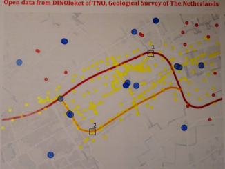
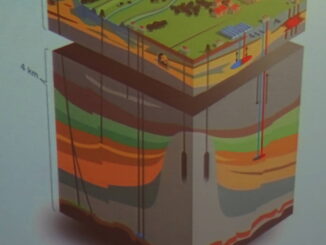
An important role for national geospatial agencies: mapping underground infrastructure

17 January 2018 Geoff Zeiss

Since Google Earth’s release in June 2005, the rise of crowdsourced OpenStreetMap, the deluge of remote-sensed imagery from private satellite companies Digital Globe, Planet Labs, UrtheCast, and others, and private geospatial data companies like HERE, […]

3D data

Excavation equipment equipped with cameras could map underground infrastructure

11 December 2017 Geoff Zeiss

The challenge of increasing urbanization in a world where anthropogenic pressure on the environment has become threatening is driving the digitalization of urban planning and the design, construction and maintenance and operations of urban infrastructure.  […]

3D data

An open source web-based platform for integrating BIM and 3D geospatial

1 December 2017 Geoff Zeiss

BIM+geospatial integration is being driven by a trend toward infrastructure construction projects that require maintenance and/or operations during an extended period post-construction.  At the GEO|Design+BIM conference in Amsterdam, Sanghee Shin, CEO of Gaia3D Inc., gave […]

3D data

European initiative to improve knowledge of the subsurface in cities

29 November 2017 Geoff Zeiss

The challenge of increasing urbanization in a world where anthropogenic pressure on the environment has become threatening is driving the digitalization of urban planning and the design, construction and maintenance and operations of urban infrastructure. […]

3D data

Elevated risk in road construction lacking knowledge of the subsurface

28 November 2017 Geoff Zeiss

The challenge of increasing urbanization in a world where anthropogenic pressure on the environment has become threatening is driving the digitalization of urban planning and design, construction and maintenance and operations of urban infrastructure. Building […]

3D data

Key registry created in the Netherlands to help model the subsurface

27 November 2017 Geoff Zeiss

Increasing urbanization throughout the world challenges the sustainable development and resilience of cities. Despite this, the importance of the ground beneath cities is often overlooked.  A lot of information about the underground is captured during […]

3D data

Shortage of skilled trade workers drives prefabrication

14 November 2017 Geoff Zeiss

At the Fall BIMForum/BuildCon conference in Dallas two presentations about actual prefabrication experience – for data centres and for large automotive plants – both mentioned shortage of skilled labour as an important motivation for turning […]

3D data

HD BIM used to design Tesla Gigafactory in record time

8 November 2017 Geoff Zeiss

At the Fall BIMForum/BuildCon conference in Dallas, an entralling presentation about how HD BIM was used to build five buildings of the Tesla Gigafactory in Nevada in record time was given by Greg Luth of […]

Posts pagination

« 1 … 15 16 17 … 30 »

Events

Notice
There are no upcoming events.

View All Events

Services

  • Post a Job
  • Post an Ad
  • Post an Event
  • Post a Directory Listing
  • Post a Press Release
  • Media Kit
  • My Account
  • Login

Jobs

Post a Job
  • Volunteer Editorial Contributor – Be Part of Canada’s Geomatics Story
    Remote
  • Junior Geomatics Field Technician – Technical Surveys
    Montréal, QC
  • GIS Specialist
    Amherst, Nova Scotia
  • Precast Structural BIM Specialist
    Calgary, Alberta
View All Jobs
  • Directories
    • Associations Directory
    • Industry Directory
    • Education Programs
    • Open Data
  • Volunteer
    • Start a GoGeomatics Group
    • Editors & Writers Group
  • About Us
    • GoGeomatics Media Kit
    • Who We Are
    • Contact Us
    • FAQ’s
    • Advertising
    • Marketing
  • Subscribe
GoGeomatics
GoGeomatics is the largest and most popular communications hub promoting the Canadian geospatial community. The business was incorporated in 2011. GoGeomatics hosts over 100 fun, free, location technology networking events each year in cities across Canada.

© 2026 GoGeomatics

  • facebook
  • Twitter
  • Linkedin
  • Youtube
  • Linkedin Group