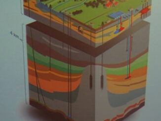
• facebook
  • Twitter
  • Linkedin
  • Youtube
  • Linkedin Group
  • Post a Job
  • Post an Ad
  • Post an Event
  • Post a Directory Listing
  • Post a Press Release
  • Media Kit
  • My Account
  • Shopping Cart
  • Login
GoGeomatics
  • MAGAZINE
    • BIM & GIS
    • Community
    • Conference news
    • Earth Observation
    • Education & Careers
    • GEOAI
    • Announcements
    • Reality Capture & Lidar
    • Science
    • Technology
    • Between the Poles
  • Directories
    • ASSOCIATION
    • INDUSTRY
    • EDUCATION
    • Open Data
  • EVENTS
    • GeoIgnite Events
    • Events Calendar
    • GoGeomatics Meetups
  • Services
    • Advertising
    • Marketing
    • Post a Job
    • Post an Ad
    • Post an Event
    • Post a Press Release
    • Post a Directory Listing
    • Media Kit
    • Web Design
  • Find a Job
  • Volunteer
    • Start a GoGeomatics Group
    • Editors & Writers Group
  • About Us
    • About Us
    • Contact Us
    • Frequently Asked Questions
  • Videos
HomeBetween the Poles – The Geoff Zeiss Archives3D data

3D data

3D data

Real time underground utility detection and damage prevention during excavation

19 May 2022 Geoff Zeiss

According to the Common Ground Alliance, excavation practices have been the root cause of between 30 – 50 % of annual damage incidents between 2015 and 2020. Now an innovative technology Live Dig Radar (LDR) […]

3D data

Subsurface digital twins: How Singapore plans to address data quality and accessibility challenges

9 February 2022 Geoff Zeiss

TThe recently published Digital Underground: Imagining a digitally enabled future is full of insights derived from a four year effort by the Singapore Land Authority in developing a road map for a coherent national mapping […]

3D data

Challenges of subsurface digital twins

10 January 2022 Geoff Zeiss

The subsurface is composed up man made infrastructure; utility, transportation, and other infrastructure and the natural environment comprised of geology and geotechnical properties of the subsurface. A comprehensive subsurface digital twin requires a digital twin […]

3D data

CSA S-250 one of the first national “as-installed” standards for underground infrastructure

22 December 2021 Geoff Zeiss

In Canada the goal of the Canadian Standards Association (CSA) S250 Standard, first published in 2011 and revised in 2020, is to specify mapping requirements for the recording and depiction of newly installed underground utility […]

3D data

New digital “as-installed” standard for underground and above-ground utility infrastructure

16 December 2021 Geoff Zeiss

Since 2002 there has been a standard, ASCE 38, for investigating and documenting existing underground utility infrastructure.  Now in the US a new standard ASCE 75 is imminent that will define a standard way to […]

3D data

SUE proposed as foundation for best practices for utility coordination on P3 projects

22 November 2021 Geoff Zeiss

Public infrastructure projects frequently experience delays and cost overruns – often due to underground utilities – but delays and cost overruns are rare on P3 projects. Furthermore because P3 projects include not only the design/build […]

No Picture
3D data

Revision to Australian AS 5488 Classification of Subsurface Utility Information

1 November 2021 Geoff Zeiss

Recently national standards relating to underground infrastructure have been revised or are being revised.  These include the US ASCE 38 with a new title Standard Guideline for Investigating and Documenting Existing Utilities, the UK PAS […]

3D data

A user platform for digital twins of underground utility infrastructure

26 October 2021 Geoff Zeiss

The foundation for digital twins of cities, regions and nations are digital geometric models.  Developing these models have become a priority for a number of jurisdictions around the world. To date the emphasis has been […]

Posts pagination

« 1 2 3 … 30 »

Events

May 3
May 3 @ 8:00 am - May 6 @ 5:00 pm

GEOINT Symposium 2026

May 11
May 11 @ 8:00 am - May 13 @ 5:00 pm

GeoIgnite 2026

May 25
May 25 - May 28

National Surveyors’ Conference 2026

May 27
May 27 @ 8:00 am - May 29 @ 5:00 pm

Canadian Cartographic Association Conference 2026

May 27
May 27 @ 8:00 am - May 29 @ 5:00 pm

CCA 2026 Conference: Coast to Coast to Coast

View Calendar

View All Events

Services

  • Post a Job
  • Post an Ad
  • Post an Event
  • Post a Directory Listing
  • Post a Press Release
  • Media Kit
  • My Account
  • Shopping Cart
  • Login

Jobs

Post a Job
  • Survey Technicians (Field and Office)
    Calgary, Alberta
  • Geospatial Analytical Technician / Technicien, analyses géospatiales; technicienne, analyses géospatiales
    Peterborough
  • Volunteer Editorial Contributor – Be Part of Canada’s Geomatics Story
    Remote
  • Jr. GIS Analyst
    Hamilton
View All Jobs
  • Directories
    • Associations Directory
    • Industry Directory
    • Education Programs
    • Open Data
  • Volunteer
    • Start a GoGeomatics Group
    • Editors & Writers Group
  • About Us
    • GoGeomatics Media Kit
    • Who We Are
    • Contact Us
    • FAQ’s
    • Advertising
    • Marketing
  • Subscribe
GoGeomatics
GoGeomatics is the largest and most popular communications hub promoting the Canadian geospatial community. The business was incorporated in 2011. GoGeomatics hosts over 100 fun, free, location technology networking events each year in cities across Canada.

© 2026 GoGeomatics

  • facebook
  • Twitter
  • Linkedin
  • Youtube
  • Linkedin Group