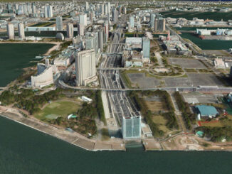
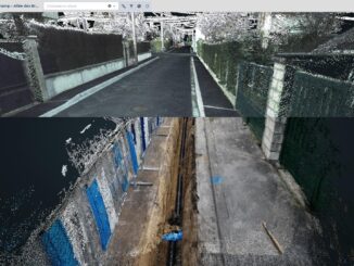
• facebook
  • Twitter
  • Linkedin
  • Youtube
  • Linkedin Group
  • Post a Job
  • Post an Ad
  • Post an Event
  • Post a Directory Listing
  • Post a Press Release
  • Media Kit
  • My Account
  • Login
GoGeomatics
  • MAGAZINE
    • BIM & GIS
    • Community
    • Conference news
    • Earth Observation
    • Education & Careers
    • GEOAI
    • Announcements
    • Reality Capture & Lidar
    • Science
    • Technology
    • Between the Poles
  • Directories
    • ASSOCIATION
    • INDUSTRY
    • EDUCATION
    • Open Data
  • EVENTS
    • GeoIgnite Events
    • Events Calendar
    • GoGeomatics Meetups
  • Services
    • Advertising
    • Marketing
    • Post a Job
    • Post an Ad
    • Post an Event
    • Post a Press Release
    • Post a Directory Listing
    • Media Kit
    • Web Design
  • Find a Job
  • Volunteer
    • Start a GoGeomatics Group
    • Editors & Writers Group
  • About Us
    • About Us
    • Contact Us
    • Frequently Asked Questions
  • Videos
HomeBetween the Poles – The Geoff Zeiss Archives3D data

3D data

3D data

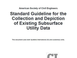
Two new standards for underground infrastructure imminent from the ASCE

30 April 2021 Geoff Zeiss

The American Society of Civil Engineers (ASCE) first introduced the ASCE 38-02 Standard Guidelines for the Collection and Depiction of Existing Subsurface Utility Data in 2002 and it has become the model for many underground […]

3D data

Canadian Underground Forum: Today is Day 2

30 April 2021 Geoff Zeiss

You can see the program for April 30 and register here. Speaker lineup An early innovator in underground utility mapping is Otto Ballintijn, CEO of Reduct which has developed inertial or gyro technology for mapping […]

3D data

Canadian Underground Forum begins tomorrow

28 April 2021 Geoff Zeiss

You can see the program for April 29 and 30 and register here. Speaker lineup One of the early innovators in applying LiDAR to mapping underground pipelines, Joseph Hlady, President at Lux Modus in Calgary, […]

3D data

A 3D base map for the globe

22 April 2021 Geoff Zeiss

At the GeoIgnite virtual event Ryan Hamilton, Senior Manager 3D Products, at Maxar described a remarkable project Globe in 3D to create a 3D model for the earth’s entire landmass using the petabytes of 50 […]

3D data

Cloud service for capturing and sharing point clouds of underground infrastructure

20 April 2021 Geoff Zeiss

Modern reality capture technology is not only providing a high accuracy alternative to paper as-builts, but is also being used to capture the location of underground utilities and other infrastructure exposed during during excavation or […]

3D data

Modern reality capture technology efficiently provides accurate as-builts for underground utilities

23 March 2021 Geoff Zeiss

Increasingly modern reality capture technology is being applied to mapping underground infrastructure.  There are two use cases where LiDAR scanning or photogrammetry can be applied two underground infrastructure. The first is when new utility infrastructure […]

3D data

Faster and safer mapping underground infrastructure using magnetometers mounted on a drone

15 March 2021 Geoff Zeiss

Technologies such as ground penetrating radar (GPR) or acoustic locating for detecting underground utilities involve directing some type of signal, electromagnetic or acoustic, into the ground and measuring the reflection off underground objects. A major […]

3D data

Standards for underground location quality are rapidly evolving

24 February 2021 Geoff Zeiss

In the last two years quality standards for location quality of underground infrastructure in the U.S., Canada, U.K. and Australia have been revised or augmented.  This reflects the accelerating development of new technologies and evolution […]

Posts pagination

« 1 … 3 4 5 … 30 »

Events

Jun 1
June 1 - June 4

CAG/CARTO Annual Meeting 2026

Jul 4
July 4 @ 8:00 am - July 11 @ 5:00 pm

ISPRS Congress 2026

Sep 15
September 15 - September 17

INTERGEO 2026

Sep 16
September 16 - September 17

Join ALL IN 2026, Montreal, Canada

Oct 26
October 26 - October 28

Canada’s National Geomatics Expo 2026

View Calendar

View All Events

Services

  • Post a Job
  • Post an Ad
  • Post an Event
  • Post a Directory Listing
  • Post a Press Release
  • Media Kit
  • My Account
  • Login

Jobs

Post a Job
  • Operations Spatial Data Assistant (Contract)
    Vaughan
  • GIS Analyst
    Saint John, New Brunswick
  • GIS Student Intern
    Elmsdale, Nova Scotia
  • Canada Impact+ Research Chair – Professor (Or Associate Professor)
    Lethbridge, Alberta
View All Jobs
  • Directories
    • Associations Directory
    • Industry Directory
    • Education Programs
    • Open Data
  • Volunteer
    • Start a GoGeomatics Group
    • Editors & Writers Group
  • About Us
    • GoGeomatics Media Kit
    • Who We Are
    • Contact Us
    • FAQ’s
    • Advertising
    • Marketing
  • Subscribe
GoGeomatics
GoGeomatics is the largest and most popular communications hub promoting the Canadian geospatial community. The business was incorporated in 2011. GoGeomatics hosts over 100 fun, free, location technology networking events each year in cities across Canada.

© 2026 GoGeomatics

  • facebook
  • Twitter
  • Linkedin
  • Youtube
  • Linkedin Group