
Dan Campbell of the City of Vancouver and I gave a presentation at WAURISA earlier this week on the Evolution of Urban Modeling. Dan outlined the history of the Vancouver model and some the business drivers that led to the development of the model.
History of the Vancouver City Model
One of the important points he made, and Dan has been involved with the development of the Vancouver model for over 15 years, is that models grow much like cities grow, incrementally. The Vancouver model started as a hardcopy model in the 1980’s, then morphed into a Drafix 3D model, then an 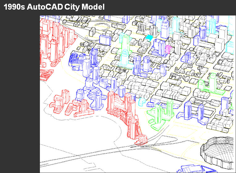
 AutoCAD city model in the 1990’s. The City first used Autodesk VIZ to visualize it,and then moved to 3ds Max
 . Now in addition to AutoCAD and 3ds Max, they are using Sketchup and Pictometry EFS.
AutoCAD city model in the 1990’s. The City first used Autodesk VIZ to visualize it,and then moved to 3ds Max . Now in addition to AutoCAD and 3ds Max, they are using Sketchup and Pictometry EFS.In the future they expect to integrate building information models (BIM) and to look at easier to use 3D urban modeling applications like LandXplorer, which have the potential to make 3D urban models more intelligent and more accessible to the public. Vancouver is one of three pilot cities that are part of a joint government/private sector initiative with Autodesk to develop new digital tools for 3D urban modeling.
Business Drivers for the Vancouver City Model
Dan also outlined some of the business drivers that motivated Vancouver to invest in a 3D model.
A recent example is the Shaw Tower. When the building was proposed, there was concern about the building being high enough to interfere with air traffic. A 3D model of the building was added to the Vancouver city model in order to determine if the building was a risk to air traffic control.
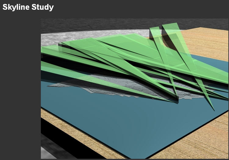 Another example is the skyline study. Vancouver is located very close to coastal mountains and is one of the most scenic cities in the world. Vancouverites want to keep it that way. Vancouver has bylaws that define and protect what are called view cones. In Seattle they are called view corridors. Vancouver has defined 20 or 30 of these. For example, if you are standing on the Cambie Street bridge, you can see Grouse Mountain. One of the view cone bylaws protects this view. The city used their 3D model to help define the view cones. You can find more about these view protection bylaws on the VanMap web site. If you’re a developer planning a building in Vancouer, you have make sure your building does not project into any of these view cones. Also if you build your building on the edge of one of these view cones you can be assured that another developer is not going to put a high rise between your building and the view.
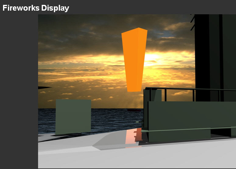 Anoher interesting example Dan mentioned is using the 3D model to help determine how to manage crowds during fireworks displays in Vancouver. A few years ago a fireworks event, which was held in English Bay, led to serious rowdyism in the West End, and as a result, the City cancelled future fireworks events. Recently, there has been pressure to restart these events, and the City used the 3D model to determine where people would congregate to see the fireworks so they could concentrated their police resources at those locations.
Currently the model is being used to model and analyse a proposed transporation hub near the Skytrain and Seabus terminals in downtown Vancouver.
Communication
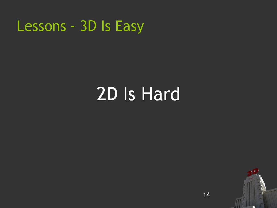 One of the most insightful points Dan made was in comparing 2D and 3D from the perspective of communication. The point he made is that “3d is easy. 2D is hard.” It is much easier for the non-technical citizen, councilman, or mayor, to grasp the implications of a proposed project from 3D simulations of proposed project than from hundreds or thousands of 2D maps and engineering drawings. To paraphrase a well-known aphorism, a 2 minute video is worth a thousand engineering drawings. Of course you still need the drawings for the technical, engineering folks, but for the average non-technical citizen, a 3D simulation is much more effective in communicating the impact of a proposed development.
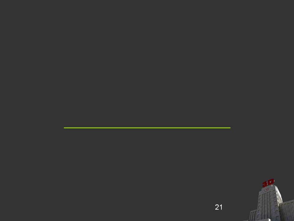 To make this point, Dan showed a slide that had nothing but a simple line and asked the audience what it represented. It could have been a road centreline, an administrative boundary, a parcel boundary, a pipe, or a telephone cable. The point is that you have to explain what it is verbally or through a legend.
 A 3D model of a city is much more intuitive for the non-technical viewer.

Be the first to comment