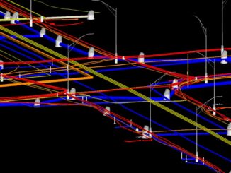
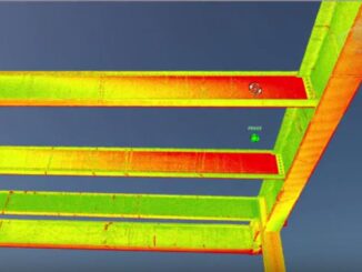
• facebook
  • Twitter
  • Linkedin
  • Youtube
  • Linkedin Group
  • Post a Job
  • Post an Ad
  • Post an Event
  • Post a Directory Listing
  • Post a Press Release
  • Media Kit
  • My Account
  • Login
GoGeomatics
  • MAGAZINE
    • BIM & GIS
    • Community
    • Conference news
    • Earth Observation
    • Education & Careers
    • GEOAI
    • Announcements
    • Reality Capture & Lidar
    • Science
    • Technology
    • Between the Poles
  • Directories
    • ASSOCIATION
    • INDUSTRY
    • EDUCATION
    • Open Data
  • EVENTS
    • GeoIgnite Events
    • Events Calendar
    • GoGeomatics Meetups
  • Services
    • Advertising
    • Marketing
    • Post a Job
    • Post an Ad
    • Post an Event
    • Post a Press Release
    • Post a Directory Listing
    • Media Kit
    • Web Design
  • Find a Job
  • Volunteer
    • Start a GoGeomatics Group
    • Editors & Writers Group
  • About Us
    • About Us
    • Contact Us
    • Frequently Asked Questions
  • Videos
HomeBetween the Poles – The Geoff Zeiss Archives3D Visualization

3D Visualization

3D data

Automating the process of comparing digital models to reality

30 May 2016 Geoff Zeiss

At the Spar 3D Expo and Conference in Houston I had the opportunity to chat with Nicolas Arnold, VP of Product Development at SKUR.  SKUR is a young software company that has just released its […]

3D data

SPAR2016: Greg Bentley on geo-coordination,mapping underground infrastructure, and information flow in construction

10 May 2016 Geoff Zeiss

At the Spar 3D Expo and Conference in Houston Greg Bentley gave a keynote in the morning in which he especially focused on reality modeling and how this technology had been applied to model in […]

3D data

Spar 3D: 3D mapping the inside of multi-story buildings with a backpack

5 May 2016 Geoff Zeiss

At the Spar 3D Expo and Conference in Houston The Woodlands, Texas, Avideh Zakhor from the University of California Berkeley was onsite with some remarkable products from her new startup Indoor Reality.  I blogged previously […]

3D data

SPAR2016: Geo-coordination key to convergence of engineering and 3D technology

3 May 2016 Geoff Zeiss

We are seeing the convergence of engineering and architecture with 3D technology and this is enabling a full lifecycle perspective in designing and constructing infrastructure where we not only aim at better project delivery, but […]

3D Visualization

SPAR2016: Augmented reality is finally going to happen, on smartphones

18 April 2016 Geoff Zeiss

I am back from two remarkable days at the Spar 3D Expo and Conference in Houston.  One thing that has stuck in my mind, because it is likely going to impact all of us, is […]

3D data

Crossrail’s huge BIM+geospatial model targeted on operations and maintenance

4 April 2016 Geoff Zeiss

The UK Government as part of its building information modeling (BIM) initiative has said repeatedly that it expects the big payoff of a digital model, estimated at more than 40% savings, will be during operations and maintenance, […]

3D data

One third of Be Inspired Awards involve mapping, managing, rehabbing and replacing aging infrastructure

18 November 2015 Geoff Zeiss

Worldwide there is increasing demand from building and infrastructure owners for service provision throughout the entire life cycle of a building or infrastructure. This represents a distinct break with the design/build tradition which has dominated […]

3D data

Modeling underground utilities in 3D reduces construction time and costs

17 November 2015 Geoff Zeiss

The location of existing underground utility infrastructure  is more often than not poorly known which creates significant risk for infrastructure and highway construction projects.  In a gas line construction project which Utility Mapping Services (UMS) […]

Posts pagination

« 1 … 3 4 5 … 16 »

Events

Jun 1
June 1 - June 4

CAG/CARTO Annual Meeting 2026

Jul 4
July 4 @ 8:00 am - July 11 @ 5:00 pm

ISPRS Congress 2026

Sep 15
September 15 - September 17

INTERGEO 2026

Sep 16
September 16 - September 17

Join ALL IN 2026, Montreal, Canada

Oct 26
October 26 - October 28

Canada’s National Geomatics Expo 2026

View Calendar

View All Events

Services

  • Post a Job
  • Post an Ad
  • Post an Event
  • Post a Directory Listing
  • Post a Press Release
  • Media Kit
  • My Account
  • Login

Jobs

Post a Job
  • Operations Spatial Data Assistant (Contract)
    Vaughan
  • GIS Analyst
    Saint John, New Brunswick
  • GIS Student Intern
    Elmsdale, Nova Scotia
  • Canada Impact+ Research Chair – Professor (Or Associate Professor)
    Lethbridge, Alberta
View All Jobs
  • Directories
    • Associations Directory
    • Industry Directory
    • Education Programs
    • Open Data
  • Volunteer
    • Start a GoGeomatics Group
    • Editors & Writers Group
  • About Us
    • GoGeomatics Media Kit
    • Who We Are
    • Contact Us
    • FAQ’s
    • Advertising
    • Marketing
  • Subscribe
GoGeomatics
GoGeomatics is the largest and most popular communications hub promoting the Canadian geospatial community. The business was incorporated in 2011. GoGeomatics hosts over 100 fun, free, location technology networking events each year in cities across Canada.

© 2026 GoGeomatics

  • facebook
  • Twitter
  • Linkedin
  • Youtube
  • Linkedin Group