• facebook
  • Twitter
  • Linkedin
  • Youtube
  • Linkedin Group
  • Post a Job
  • Post an Ad
  • Post an Event
  • Post a Directory Listing
  • Post a Press Release
  • Media Kit
  • My Account
  • Login
GoGeomatics
  • MAGAZINE
    • BIM & GIS
    • Community
    • Conference news
    • Earth Observation
    • Education & Careers
    • GEOAI
    • Announcements
    • Reality Capture & Lidar
    • Science
    • Technology
    • Between the Poles
  • Directories
    • ASSOCIATION
    • INDUSTRY
    • EDUCATION
    • Open Data
  • EVENTS
    • GeoIgnite Events
    • Events Calendar
    • GoGeomatics Meetups
  • Services
    • Advertising
    • Marketing
    • Post a Job
    • Post an Ad
    • Post an Event
    • Post a Press Release
    • Post a Directory Listing
    • Media Kit
    • Web Design
  • Find a Job
  • Volunteer
    • Start a GoGeomatics Group
    • Editors & Writers Group
  • About Us
    • About Us
    • Contact Us
    • Frequently Asked Questions
  • Videos
HomeBetween the Poles – The Geoff Zeiss ArchivesAccess to Spatial Data

Access to Spatial Data

Access to Spatial Data

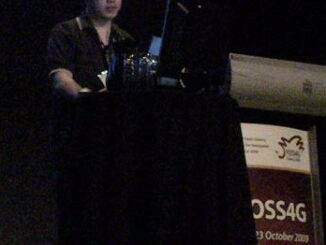
FOSS4G: Jackie Ng on the FDO Toolbox

23 October 2009 Geoff Zeiss

Wednesday at FOSS4G Jackie Ng gave a presentation on the FDO Toolbox.  It was presented so well that I was flabbergasted to discover subsequently from one of Jackie’s blog that this was his first public […]

Access to Spatial Data

FOSS4G Sydney: Senator Kate Lundy on Government 2.0 and Open Geospatial Data

23 October 2009 Geoff Zeiss

I’ve been at FOSS4G 2009 here in Sydney for the last few days.  This has been an exceptionally interesting conference and given that Sydney is a long way for many people, there has been a […]

Access to Spatial Data

Microsoft Rebrands Virtual Earth and Live Search Maps

4 June 2009 Geoff Zeiss

As part of its announcement of its new search engine Bing, Microsoft has rebranded  Virtual Earth (which MS calls a mapping platform), now called “Bing Maps for Enterprise”  Live Search Maps ( which is MS’s […]

Access to Spatial Data

GDAL Support for Oracle Georaster

6 May 2009 Geoff Zeiss

At GITA last week I ran into Steve Serra from Oracle who updated me on open source support for Oracle Spatial/Locator.  He provided a site where open source products supporting Oracle Spatial are listed. The […]

Access to Spatial Data

California Appeals Court Supports Free Access to Geopatial Data

8 February 2009 Geoff Zeiss

Public access to county GIS data in California is gathering legal precedents. The California Court of Appeal in a unanimous decision affirmed the Santa Clara County Superior Court’s decision requiring Santa Clara County to comply […]

No Picture
Access to Spatial Data

Contribution of Spatial Information to the National Economy

9 December 2008 Geoff Zeiss

I have just returned to Ottawa after attending a GITA Board of Directors meeting in California.  I chanced to chat with Daniel Shannon of Telus about some interesting macroeconomic reports that I had come across. […]

Access to Spatial Data

Proposal for Simplifying FDO Schema and Class Names

22 September 2008 Geoff Zeiss

Last week I was in Australia and had a chance to touch base with Zac Spitzer , who is the Solution Architect with Ennoble Consultancy and who was responsible for implementing the architectural design pattern […]

Access to Spatial Data

Safe Software: FME Supports AutoCAD Map3D Object Data

16 September 2008 Geoff Zeiss

Safe Software has announced today that FME supports full read and write capability for AutoCAD Map 3D object data.  Object data is used to associate properties with graphical entities in an AutoCAD DWG file.  Safe’s […]

Posts pagination

« 1 … 13 14 15 16 »

Events

Notice
There are no upcoming events.

View All Events

Services

  • Post a Job
  • Post an Ad
  • Post an Event
  • Post a Directory Listing
  • Post a Press Release
  • Media Kit
  • My Account
  • Login

Jobs

Post a Job
  • Volunteer Editorial Contributor – Be Part of Canada’s Geomatics Story
    Remote
  • Junior Geomatics Field Technician – Technical Surveys
    Montréal, QC
  • GIS Specialist
    Amherst, Nova Scotia
  • Precast Structural BIM Specialist
    Calgary, Alberta
View All Jobs
  • Directories
    • Associations Directory
    • Industry Directory
    • Education Programs
    • Open Data
  • Volunteer
    • Start a GoGeomatics Group
    • Editors & Writers Group
  • About Us
    • GoGeomatics Media Kit
    • Who We Are
    • Contact Us
    • FAQ’s
    • Advertising
    • Marketing
  • Subscribe
GoGeomatics
GoGeomatics is the largest and most popular communications hub promoting the Canadian geospatial community. The business was incorporated in 2011. GoGeomatics hosts over 100 fun, free, location technology networking events each year in cities across Canada.

© 2026 GoGeomatics

  • facebook
  • Twitter
  • Linkedin
  • Youtube
  • Linkedin Group