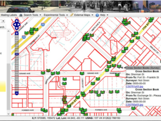
Access to Spatial Data
UK’s Geospatial Commission could play a role in the digital transformation of construction
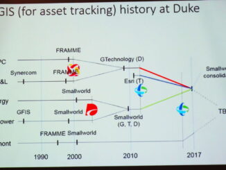
Governments are consolidating the role of geospatial data and technology in central governments. I have blogged about the Geospatial Data Act of 2017 in the U.S. Studies of the value of spatial data and technology […]