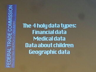
Access to Spatial Data
G8 leaders sign charter on open data including geospatial and infrastructure
G8 leaders (Canada, France, Germany, Italy, Japan, Russia, United Kingdom, United States, and the European Union) signed a charter on open data. The Open Data Charter sets out 5 strategic principles that all G8 members […]