
A report by the “Global Forest Expert Panels” initiative, which is led by the International Union of Forest Research Organizations (IUFRO) has been released. It forecasts what the impact of global warming might be on the world’s forests.
As reported by Natural Resources Canada , the Intergovernmental Panel on Climate Change (IPCC) has produced projections of green house gas emissions (GHG) and global surface temperatures through 2100. The original 2001 report has been recently updated (Climate Change 2007: Impacts , Adaptation and Vulnerability. Working Group II Contribution to the Fourth Asesment Report of the Intergovernmental Panel on Climate Change.)
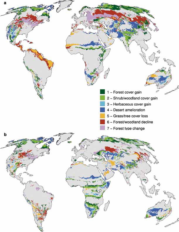 Based on these projections the Global Forest Experts Panel has forecasted what the Earth’s forest cover might look like in 2100 under different scenarios.
Scenario “a”
This scenario is business as usual. GHG emissions continue to grow over the rest of the century at rates similar to those in the second half of the 20th century.
Scenarion “b”
GHG emissions decline during the current century as a result of major green initiatives permitting atmospheric CO2 concentrations to approach a new equilibrium by the year 2100.
The detailed projection of the impact of Scenario a (business as usual) on Canadian forests, specifically, were modeled by Natural Resources Canada and were published yesterday in the Globe and Mail.
The areas where forests would be most negatively affected are the subtropical and temperate areas including southern and western Canada, western U.S., northern China, southern Europe, Australia
and subtropical Africa. The reports suggests that some parts of the US West would become so arid that forests would cease to exist.
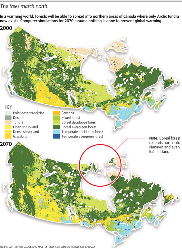 But for northern countries like Canada, Sweden, Finland and Russia, the temperature increase would open up areas of the far north to forestation. Boreal forests would start to shift northward. Areas like Baffin Island, the northern coast of Hudson Bay, Southampton Island, the Ungava Peninsula in Quebec, and the northern tip of Labrador, which are now above the tree line, could become forested, even by as soon as 2070.

Be the first to comment