California State CIO Teri Takai on California’s IT Priorities

One of the most interesting presentations at the National Guard’s JIMC conference in San Diego was the California State CIO Teri Takai’s
keynote on the challenges facing the state government’s IT folks. In 2006 Governor Schwarzenegger decided that the state needed a cabinet level CIO position to oversea the state’s 10 000 IT employees, $3 billion annual IT budget, and 130 departmental CIO’s and Teri Takai, who was then State CIO of the State of Michigan, was brought on board.

Top Technology Challenges  California IT Technology Challenges

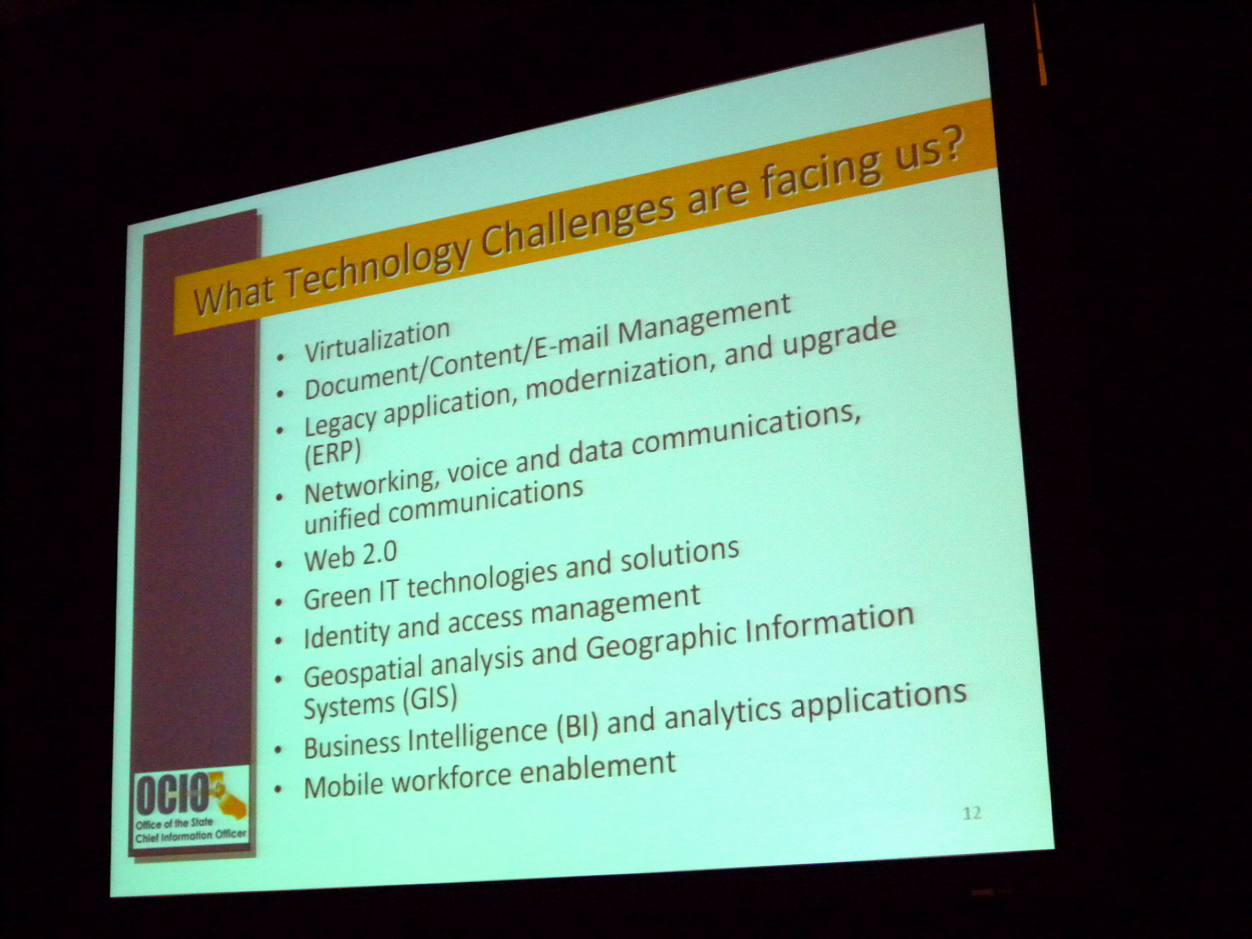
The top technology challenges for the state government in California are driven by a few key principles, consolidation (turf battles are no longer cool), focus on the customer (helps get around turf battles), and collaboration (no longer a luxury).

Among the top technology challenges for the State of California is geospatial technology.

Governor Schwarzenegger’s Geospatial Strategy in California

In May, 2008 Governor Schwarzenegger called for the creation of a task force to develop a statewide strategy to enhance geospatial technology for

  • environmental protection,
  • natural resource management,
  • traffic flow,
  • emergency preparedness and response,
  • land use planning and
  • health and human services.

and tasked the State CIO for a strategy and plan to accomplish this. To get the ball rolling, in June 2008 Teri Takai sponsored the More than a Map geospatial forum which was held in Sacramento, and where I had the opportunity to present.  The next step that Teri Takai announced at the JIMC conference was that within the next few months the State of California will be announcing its first Geospatial Information Officer (GIO).

Geoff Zeiss

Geoff Zeiss

Geoff Zeiss has more than 20 years experience in the geospatial software industry and 15 years experience developing enterprise geospatial solutions for the utilities, communications, and public works industries. His particular interests include the convergence of BIM, CAD, geospatial, and 3D. In recognition of his efforts to evangelize geospatial in vertical industries such as utilities and construction, Geoff received the Geospatial Ambassador Award at Geospatial World Forum 2014. Currently Geoff is Principal at Between the Poles, a thought leadership consulting firm. From 2001 to 2012 Geoff was Director of Utility Industry Program at Autodesk Inc, where he was responsible for thought leadership for the utility industry program. From 1999 to 2001 he was Director of Enterprise Software Development at Autodesk. He received one of ten annual global technology awards in 2004 from Oracle Corporation for technical innovation and leadership in the use of Oracle. Prior to Autodesk Geoff was Director of Product Development at VISION* Solutions. VISION* Solutions is credited with pioneering relational spatial data management, CAD/GIS integration, and long transactions (data versioning) in the utility, communications, and public works industries. Geoff is a frequent speaker at geospatial and utility events around the world including Geospatial World Forum, Where 2.0, MundoGeo Connect (Brazil), Middle East Spatial Geospatial Forum, India Geospatial Forum, Location Intelligence, Asia Geospatial Forum, and GITA events in US, Japan and Australia. Geoff received Speaker Excellence Awards at GITA 2007-2009.

View article by Geoff Zeiss

Be the first to comment

Leave a Reply

Your email address will not be published.


*