
Wednesday I had the opportunity to speak at a unique seminar organized by Consortech in Montreal which brought together civil and structural engineers and GIS folks in the same room. Pierre Genest, the president of Consortech, told me the audience of about 130 was close to evenly split between engineering and geospatial. To me this is further evidence of the convergence that is taking place and that is breaking down the walls between traditional GIS, CAD, and BIM.
The technology that is enabling this to happen was very much in evidence. Tom Schoenhofer from Leica talked about the latest advances in terrestrial laser-scanning, and Consortech talked about how Oracle Spatial enables the storing and manipulation of point clouds. Frédéric Brière of the Quebec Transportation Ministry outlined how LiDAR is being used to digitize the entire road network of Quebec. Consortech demonstrated AutoCAD Map 3D 2010 and Civil 3D 2010’s support for point clouds.
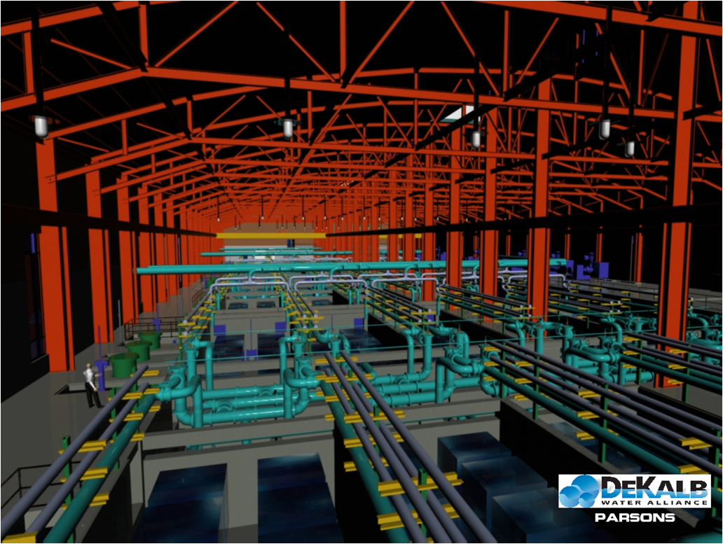 Consortech demonstrated how Navisworks can integrate data from different sources to enable clash detection and 4D modeling using project management data from Primavera or Microsoft Project. Consortech also announced support for two new products, LandXplorer and Dynamite VSP. LandXplorer enables the 3D modeling of entire urban environments (digital cities) by integrating data from engineering and GIS data sources. Dynamite VSP integrates civil engineering data from Civil3d, Bentley InRoads, Geopak, and other civil engineering design software to create 3D visualizations running in 3ds Max. Simon Bouffard from Genivar described their integrated approach to 3D simulation called Geo-Design and showed some fascinating examples of projects they have completed using this approach with municipal governments and other clients.
The guest speaker at lunch was Luc Levecque from the City of Montreal who talked from a GIS manager’s perspective about the necessity of combining engineering and geospatial data to be able to model and simulate complex urban environments.
 Kevin Wiebe from Safe Software hit the nail on the head in his presentation on interoperability. Geospatial interoperability has made a lot of progress over the past couple of decades, but the challenge of integrating engineering, architecture, GIS, utility infrastructure models, communications models, building information models (BIM), road and highway models, and other sources is a tremendous challenge. Safe Software’s FME and FME server products support 3D models such as BIM, and Kevin said that Safe’s support for model-based design data stores is accelerating.
I think what is creating the common ground for engineers, utility designers, and GIS folks is model-based design (BIM); 3D visualization, analysis and simulation; and the vision of digital cities. I commend Consortech for recognizing this trend and putting together a seminar that brought engineers and GIS folks together in the same room. As Kevin Wiebe said, “the conference was really a great opportunity to be a part of the buzz that is growing around 3D … I am excited about the possibilities of where this will go, and I think you are right that there really is the emerging of a brand new economy.“

Be the first to comment