
WAURISA was kicked off by a very interesting presentation by Cy Smith, Oregon Geographic Information Officer (OGIO) and Past President of the National States Geographic Information Council (NSGIC). He outlined the NSGIC strategic framework for a national geospatial infrastructure. He gave a status report on the National Spatial Data Infrastructure (NSDI) initiative in the US, including 50+ SSDI’s, governance, Datasets for the Nation (imagery, transportation, addressing, and elevation), national funding, advocacy, and technology.
 One of the points he made that particularly caught my attention is that the State of Oregon spends over $4 billion (million ?) annually on spatial data and that number does not include federal spending in the state. If you assume that every state is spending something on the same order of magnitude, you arrive at a very large number for spending on spatial data for all fifty states. One of the objectives of the NSGIC stratetgic framework is to rationalize this spending, to reduce duplication, for example.
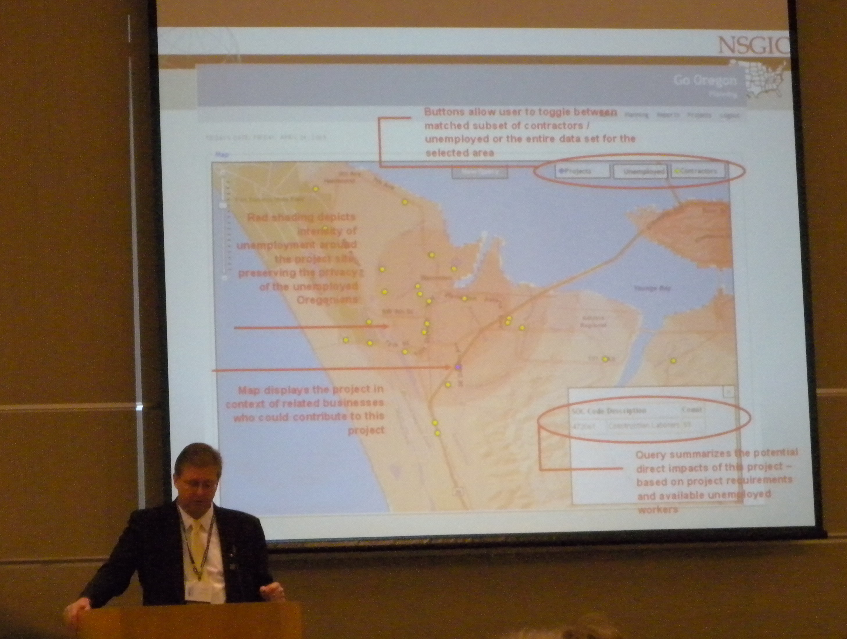
One of the innovative things that the OGIO’s office is implementing is a web-based geospatial application for tracking ARRA and state stimulus spending in the State of Oregon. This allows the state to track all stimulus projects and to do things like matching project resource requirements to the skills of unemployed in the state.

Be the first to comment