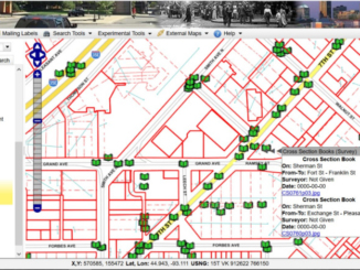
Access to Spatial Data
First step toward developing a national infrastructure map to enable smart investments
In its 2017 Infrastructure Report Card, the American Society of Civil Engineers (ASCE) assigned an overall grade of D+ to U.S. infrastructure. Addressing the problem of bringing national infrastructure up to a standard where it […]