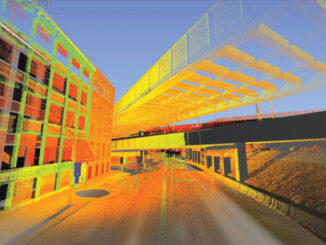
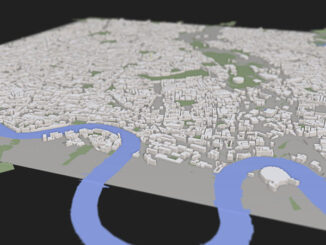
• facebook
  • Twitter
  • Linkedin
  • Youtube
  • Linkedin Group
  • Post a Job
  • Post an Ad
  • Post an Event
  • Post a Directory Listing
  • Post a Press Release
  • Media Kit
  • My Account
  • Login
GoGeomatics
  • MAGAZINE
    • BIM & GIS
    • Community
    • Conference news
    • Earth Observation
    • Education & Careers
    • GEOAI
    • Announcements
    • Reality Capture & Lidar
    • Science
    • Technology
    • Between the Poles
  • Directories
    • ASSOCIATION
    • INDUSTRY
    • EDUCATION
    • Open Data
  • EVENTS
    • GeoIgnite Events
    • Events Calendar
    • GoGeomatics Meetups
  • Services
    • Advertising
    • Marketing
    • Post a Job
    • Post an Ad
    • Post an Event
    • Post a Press Release
    • Post a Directory Listing
    • Media Kit
    • Web Design
  • Find a Job
  • Volunteer
    • Start a GoGeomatics Group
    • Editors & Writers Group
  • About Us
    • About Us
    • Contact Us
    • Frequently Asked Questions
  • Videos
HomeBetween the Poles – The Geoff Zeiss ArchivesDigital Cities

Digital Cities

3D data

Automated code-checking: Review of 28 national, state, city and third-party BIM standards and guidelines

2 May 2014 Geoff Zeiss

Checking regulatory compliance for building permitting remains a tedious, time-consuming and costly process. While the critical importance of timely, accurate, and uniform code review has been an important goal of regulatory agencies for some time […]

3D data

Construction industry moving to maximize geospatial content

28 April 2014 Geoff Zeiss

At the SPAR International conference Kevin Gilson, Director of the Design Visualization group at  Parsons Brinckerhoff (PB) gave an insightful presentation on integrated 3D modeling and visualization for large transportation projects with some examples from […]

3D data

3D is transforming the construction industry and helping to build a new world

1 April 2014 Geoff Zeiss

Increasing urbanisation, pressure on existing infrastructure, push for productivity in construction sector and environmental concerns are driving the convergence of geospatial, 3D and information modeling technologies. Over the next two decades, construction of buildings and […]

3D Visualization

Convergence of BIM, geospatial, imagery and 3D enables new vertical industry solutions

17 October 2013 Geoff Zeiss

Earlier this year I was invited to give a keynote at the South Africa Surveying and Mapping Indaba.  PositionIT has just published the paper Geospatial Information Technology Enables Vertical Industry Solutions based on my keynote. […]

3D data

Towards spatial standards for the Internet of Things (IoT)

15 October 2013 Geoff Zeiss

Geospatial information is a cross-cutting requirement critical to many different domains.  Therefore the Open Geospatial Consortium (OGC) has entered into alliances with standards organizations in many different sectors from buildings to transportation to utilities and […]

3D data

SimCity with real data: modeling real cities in 3D in a Web environment

20 September 2013 Geoff Zeiss

At FOSS4G in Nottingham I was looking forward to hearing Peter Smart and Rob Hawkes talk about their ViziCities project which is intended to bring real world cities to life using open, big-data and open […]

Between the Poles – The Geoff Zeiss Archives

Smart cities: BIM, GIS and the internet of things

18 September 2013 Geoff Zeiss

At the AGI Geocommunity Conference Dr Andrew Hudson-Smith, Director of the  Centre for Advanced Spatial Analysis (CASA)  at The Bartlett, University College London, gave a fascinating introduction to the topic of smart cities and how […]

3D data

ESRI UC: 3D and other themes of this year’s conference

10 July 2013 Geoff Zeiss

According to Jack Dangermond who led the plenary sessions on the first day,  this year in San Diego 12000 people from 130 countries were in San Diego for the 33rd Esri International User Conference. I […]

Posts pagination

« 1 … 3 4 5 … 11 »

Events

May 27
May 27 @ 8:00 am - May 29 @ 5:00 pm

Canadian Cartographic Association Conference 2026

Jun 1
June 1 - June 4

CAG/CARTO Annual Meeting 2026

Jul 4
July 4 @ 8:00 am - July 11 @ 5:00 pm

ISPRS Congress 2026

Sep 15
September 15 - September 17

INTERGEO 2026

Sep 16
September 16 - September 17

Join ALL IN 2026, Montreal, Canada

View Calendar

View All Events

Services

  • Post a Job
  • Post an Ad
  • Post an Event
  • Post a Directory Listing
  • Post a Press Release
  • Media Kit
  • My Account
  • Login

Jobs

Post a Job
  • Operations Spatial Data Assistant (Contract)
    Vaughan
  • GIS Analyst
    Saint John, New Brunswick
  • GIS Student Intern
    Elmsdale, Nova Scotia
  • Canada Impact+ Research Chair – Professor (Or Associate Professor)
    Lethbridge, Alberta
View All Jobs
  • Directories
    • Associations Directory
    • Industry Directory
    • Education Programs
    • Open Data
  • Volunteer
    • Start a GoGeomatics Group
    • Editors & Writers Group
  • About Us
    • GoGeomatics Media Kit
    • Who We Are
    • Contact Us
    • FAQ’s
    • Advertising
    • Marketing
  • Subscribe
GoGeomatics
GoGeomatics is the largest and most popular communications hub promoting the Canadian geospatial community. The business was incorporated in 2011. GoGeomatics hosts over 100 fun, free, location technology networking events each year in cities across Canada.

© 2026 GoGeomatics

  • facebook
  • Twitter
  • Linkedin
  • Youtube
  • Linkedin Group