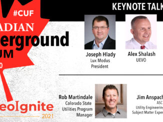
Canadian Underground Forum: Today is Day 1
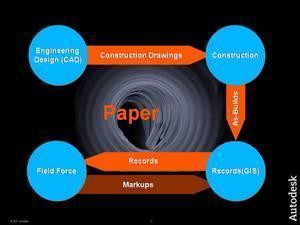
We are starting at 10 AM EDT. You can see the program for April 29 and register here. Today’s speaker lineup One of the early innovators in applying LiDAR to mapping underground pipelines, Joseph Hlady, […]
You can see the program for April 29 and 30 and register here. Speaker lineup One of the early innovators in applying LiDAR to mapping underground pipelines, Joseph Hlady, President at Lux Modus in Calgary, […]
The only instance I know of in North America of a province or state wide database that includes maps of utility infrastructure is the Integrated Cadastral Information Society (ICI Society) in British Columbia. The ICI […]
The vision of a single map showing all underground utilities and communications infrastructure is shared by many who are involved in planning, engineering and construction and those developing digital twins. But in many jurisdictions there […]
There are fundamental differences between above- and below-ground data which may limit the usefulness of underground data in digital twins. For location data about the underground there are often data quality issues, legal restrictions on […]
Estonia is well known as one of the most digital countries in Europe. At the GEOBIM 2020 conference this morning Christopher-Robin Raitviir, of the Estonian Department of Digital Construction in the Ministry of Economic Affairs […]
Most of underground utility damage during construction is attributable to incomplete, inaccurate and out of date records and network documentation. This data is the result of an inefficient, error-prone, and paper-based information flow from engineering, […]
Geospatial and BIM have been identified as key technologies in the digital transformation of the global construction sector which has been underperforming for decades. A recent report estimates the size of the contribution of geospatial+BIM […]