FOSS4G: Jackie Ng on the FDO Toolbox

Wednesday at FOSS4G Jackie Ng gave a presentation on the FDO Toolbox.  It was presented so well that I was flabbergasted to discover subsequently from one of Jackie’s blog that this was his first public presentation.  

There are a couple of important reasons why it is worthwhile talking a look at FDO Toolbox.  First of all, it is built on the .Net platform which differentiates it from the alternative C++ and Java tools.  If you are used to working in a Windows .Net environment, you will feel at home here. Secondly, Jackie has put a lot of effort into the UI so the FDO Toolbox is simple to use. Thirdly, it is a comprehensive schema and data management tool that can handle geospatial and non-geospatial data with equal facility.  I was very impressed with how many things you can do with FDO Toolbox including 

Data Management (ETL)

  • Create and edit data models (schemas)
  • Read and write geospatial data for up to 150 data sources supported by FDO

FDO Toolkit Preview 
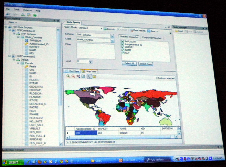
Data Preview (maps for geospatial data)

  • FDO query
  • SQL query

Batch automation

  • Batch scripting to automate common geo-processing tasks

Translation (FDO2FDO)

  • Bulk copy selected geospatial data from one FDO data source to another
  • Fast copy one FDO data source to another, not quite one-click but pretty close

Extensibility

  • FDO Toolbox can be extended through extension modules. With extension modules you can add new commands in C# for custom functionality and include new menu entries to expose them in the user interface.

Jackie demonstrated the latest release of the FDO Toolbox 0.8.7 which includes a dramatically improved bulk copy with a completely revamped user interface and XML file definition.  Also FDO Toolbox now supports Python scripting.

Geoff Zeiss

Geoff Zeiss

Geoff Zeiss has more than 20 years experience in the geospatial software industry and 15 years experience developing enterprise geospatial solutions for the utilities, communications, and public works industries. His particular interests include the convergence of BIM, CAD, geospatial, and 3D. In recognition of his efforts to evangelize geospatial in vertical industries such as utilities and construction, Geoff received the Geospatial Ambassador Award at Geospatial World Forum 2014. Currently Geoff is Principal at Between the Poles, a thought leadership consulting firm. From 2001 to 2012 Geoff was Director of Utility Industry Program at Autodesk Inc, where he was responsible for thought leadership for the utility industry program. From 1999 to 2001 he was Director of Enterprise Software Development at Autodesk. He received one of ten annual global technology awards in 2004 from Oracle Corporation for technical innovation and leadership in the use of Oracle. Prior to Autodesk Geoff was Director of Product Development at VISION* Solutions. VISION* Solutions is credited with pioneering relational spatial data management, CAD/GIS integration, and long transactions (data versioning) in the utility, communications, and public works industries. Geoff is a frequent speaker at geospatial and utility events around the world including Geospatial World Forum, Where 2.0, MundoGeo Connect (Brazil), Middle East Spatial Geospatial Forum, India Geospatial Forum, Location Intelligence, Asia Geospatial Forum, and GITA events in US, Japan and Australia. Geoff received Speaker Excellence Awards at GITA 2007-2009.

View article by Geoff Zeiss

Be the first to comment

Leave a Reply

Your email address will not be published.


*