
Dan Campbell of the City of Vancouver gave an outstanding presentation to a standing-room only crowd at Map Asia 2009 in Singapore yesterday on Vancouver’s 3D city model.
History
Dan has been involved with the development of the Vancouver 3D city model for over 15 years. One of the important messages for a town or city interested in developing a 3D model is that models grow incrementally, much like cities and towns grow. The Vancouver model started as a hardcopy model in the 1980’s, became a Drafix 3D model, then an AutoCAD city model in the 1990’s. The City first used Autodesk VIZ to visualize it,and then moved to 3ds Max . Now in addition to AutoCAD and 3ds Max, they are using Sketchup and Pictometry EFS.
In the future they expect to integrate building information models (BIM) and LandXplorer, which have the potential to make 3D urban models more intelligent and more accessible to the public.
Business Drivers: Some examples
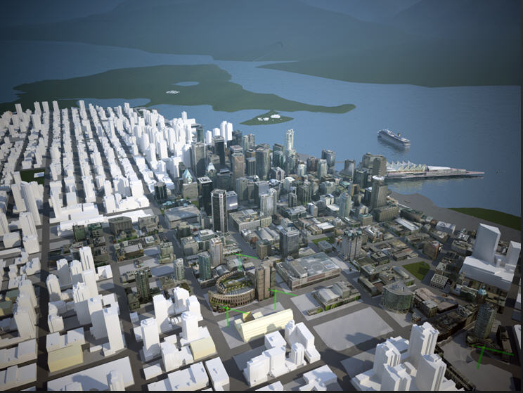 The Shaw Tower is one of the highest buildings in Vancouver. When the building was proposed, there was concern about the building being high enough to interfere with harbour air traffic. A model of the building was added to the Vancouver 3D city model to verify that the building was not a risk to float plane traffic.
Vancouver is located very close to coastal mountains and is one of the most scenic cities in the world and Vancouverites want to keep it that way. To do this Vancouver has developed bylaws that define and protect what are called view cones. For example, the view cone bylaws protects views of Grouse Mountain and the Lions from various locations in the city. If you’re a developer planning a building in Vancouer, you have to make sure your building does not project into any of these view cones. Defining and ensuring compliance with the view cone bylaws is much easier to do with a 3D model.
3D as a Communication Medium
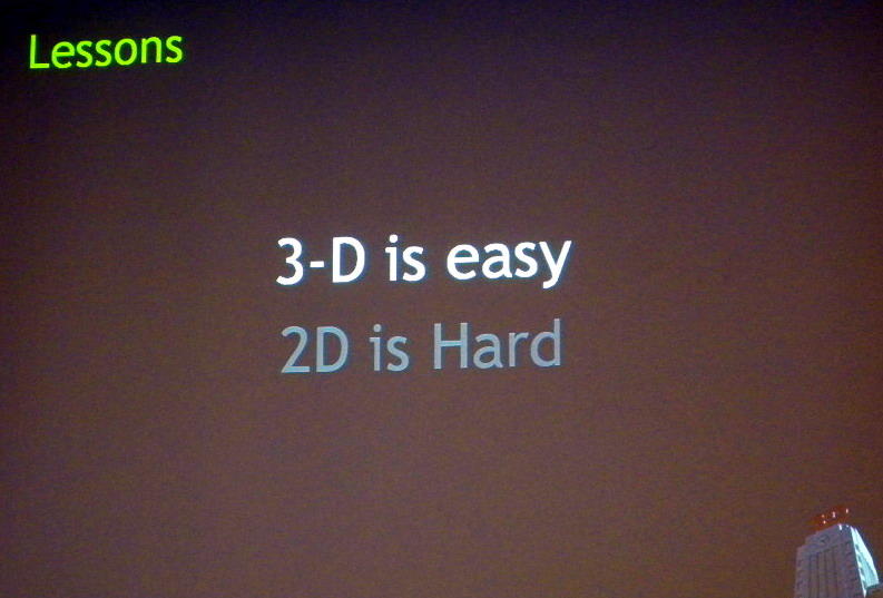 One of the most insightful points Dan made was in comparing 2D and 3D as a communication medium. It is much easier for the non-technical citizen, councilman, or mayor, to grasp the implications of a proposed project from a 3D simulation than from hundreds of 2D maps and engineering drawings. The corollary is that it is harder work for the city planner to prepare a 3D simulation than 2D maps or drawings, though Dan hopes that with tools like LandXplorer, this will become easier.
Be the first to comment