
Non-vendor general geospatial conferences are having a challenging time these days. There are alternative explanations for why this is happening. Some say it is the result of geospatial no longer being special, that it is now part of standard IT functionality in most vertical application areas, others that customers have for the most part made their “GIS decision” and are now going to the user conference of their vendor of choice.
Several years ago GIS Development, the organizer of Map Asia and other international geospatial conferences, decided to broaden the appeal of what had been originally GIS conferences by including more vertically focussed sub-conferences. For example, this year Map Asia, which is taking place in Kuala Lumpur, includes several vertical sub-conferences.
- Symposium on Utility and Infrastructure
- Agriculture and Plantation Seminar
- Ocean Information Services Seminar
- Special Session on Geospatial for Socioeconomic Development
The Utility and Infrastructure Symposium, which took place today, was a day long symposium with speakers presenting on a wide range of infrastructure related topics including roads and highways, energy, water, electricity, gas, port infrastructure, and telecommunications. The presentations all focussed on addressing vertical domain specific problems using geospatial and other technology.
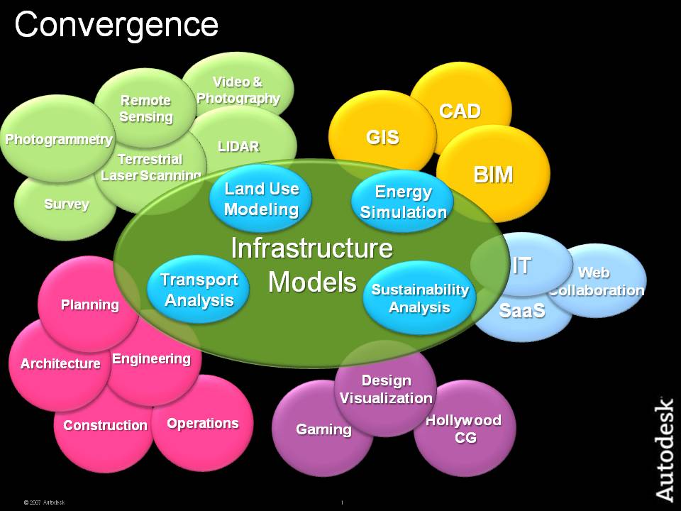 The opening session at which I spoke was very well attended, in fact packed, with over a hundred people by my estimate. It was a very attentive, mature audience and there were several excellent questions afterward. My conclusion is that GIS Development are onto something, that geospatial has matured to the point where people are no longer primarily interested in GIS per se, but in learning about how problems in specific vertical sectors can be addressed using geospatial together with other technology.

Be the first to comment