
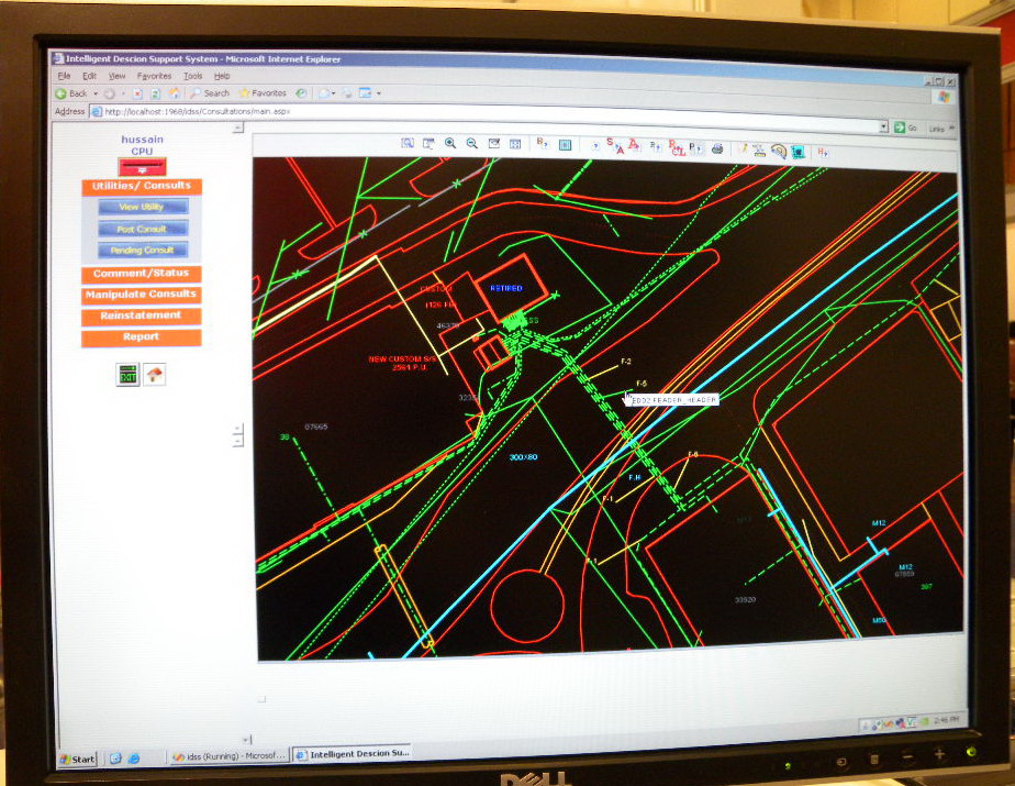
Today at MEST 2009, I had the opportunity to see a system for maintaining a single database containing all underground infrastructure in Bahrain. A single repository for all underground facilities is something that is only possible in a very few places in the world such as Tokyo and other Japanese cities, Sarajevo, Calgary, and Edmonton, which are the ones I am aware of. The system I saw is the Intelligent Decision Support System (iDSS) of the Ministry of Works and it was shown to me by Mr. Abbas Ally, Head of Central Planning Engineering in the Central Planning Office (CPO).
The Bahrain underground infrastructure system is unique for several reasons.
One Database of All Underground Infrastructure
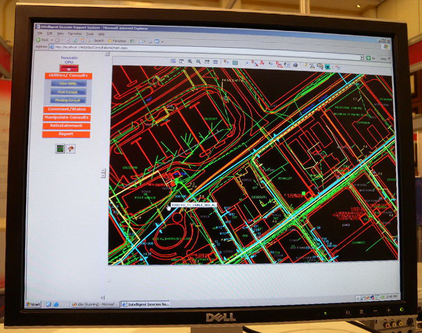 According to Mr. Abbas the location of all underground infrastructure in Bahrain is stored in a single Oracle Spatial RDBMS.
- electricity including transmission, distribution, and street lighting,
- water including transmission and distribution,
- wastewater including storm, road, sanitary, and combined
- telecommunications
Stewardship
The source databases are maintained by the respective owners, water and electricity by the Water and Electricity Authority, telecommunications by Batelco, and wastewater by the Ministry of Works. iDSS has several layers of security, using OS and Oracle security, that determines who can see what, and who can update what.
Frequent Updates
 The intention is for each operational database to be replicated to the iDSS database, which means that the iDSS database will be as up-to-date as the source databases are, though this capability does not appear to be functional at the present time. In the short time that I have been here I haven’t been able to determine how reliable the individual source databases, electricity, water, wastewater, and telecommunications, are.
Excavation Requests
Anyone proposing to add to or make a change to undergound infrastructure is required to complete a Proposal Request, essentially a building permit. The request is forwarded electronically to all of the participating utilities, who are required to review and respond to the request within three days. Utilities who don’t respond within three days are assumed to have approved the request. In 2008 over 7,000 requests were processed.
Voluntary
Accordng to Mr. Abbas, participation in iDSS is voluntary, but all utilities and Batelco are participating. Mr. Abbas explained that the primary reason that all the utility and telecommunications companies have agreed to participate is the business benefits they see resulting from participation. Given the amount of money utilities and telcos in North America spend on locating underground facilities in response to Call-Before-You-Dig and One-Call centers requests, I expect the business benefits to the individual utilities are considerable.

Be the first to comment