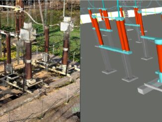
3D data
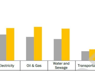
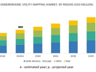
Ground penetrating radar market estimated at US$ 493 million in 2019
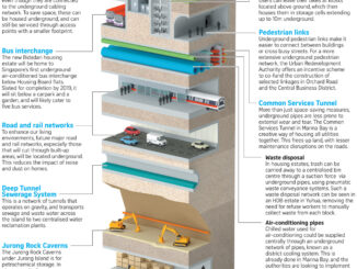
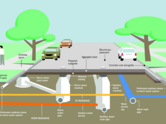
Utility locating involves remote-sensing and safe excavation technologies for identifying, detecting, and labeling the underground utility infrastructure including telecommunication, storm and sanitary sewers, water, electricity distribution, natural gas, cable television, fiber optics, heating and others. […]