Between the Poles – The Geoff Zeiss Archives
OGC workshop focusses on challeges to achieving interoperability for location of underground infrastructure
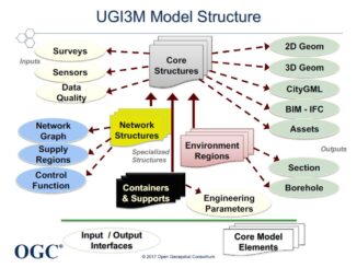
In July the Open Geospatial Consortium (OGC) held an underground Infrastructure ETL (export-transform-load) – Plugfest at the Fund for New York City (FCNY). The central theme was development of a Model for Underground Data Definition […]