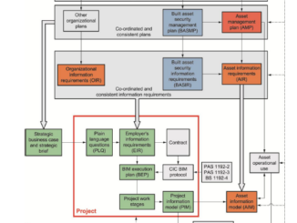
Between the Poles – The Geoff Zeiss Archives
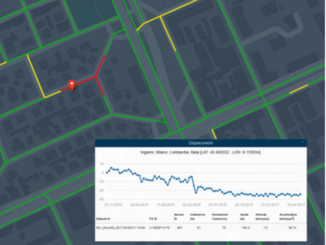
Monitoring integrity of water networks with satellites
I am at HxGNLive in Las Vegas this week. One of the several very interesting presentations with important implications for a number of industries is a talk by Massimo Zotti of Planetek. He described an […]