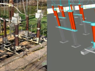
3D data
Total articles: 2505
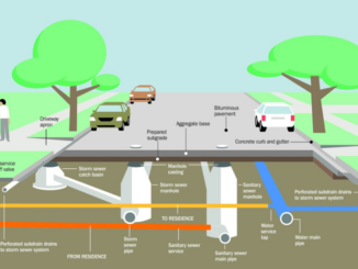
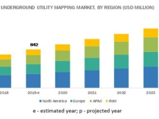
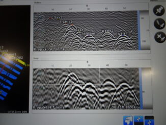
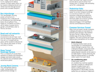
Utility locating involves remote-sensing and safe excavation technologies for identifying, detecting, and labeling the underground utility infrastructure including telecommunication, storm and sanitary sewers, water, electricity distribution, natural gas, cable television, fiber optics, heating and others. […]

Register