SpatialInfo User Conference: Using Dark Fiber Trace for Cellular Backhaul Design

SPATIALInfo is holding its 2009 User Conference at Beaver Run Resort and Conference Center in Breckenridge, Colorado at which I gave a keynote. The event is extremely well attended by telco, cable, power, municipal utility and engineering companies.  

I heard a fascnating presentation by Mike Springer and Peter Dart about cellular backhaul. Cellphone antennas are typically connected to the telephone network using T1 lines, but cell phone operators are increasingly finding that T1 is limiting capacity and are looking for other alternatives.  One way is to link to the nearest fiber network, which is often owned and operated by a cable company.  

PalmAntenna

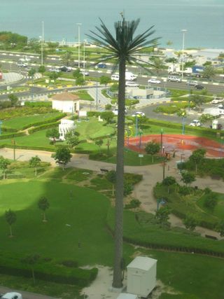
What Mike first showed was using SpatialNET to locate a cellphone antenna tower and then find the nearest fiber splice point.  The coolest thing that Mike showed was to use a tool called dark fiber trace to trace the fiber network from the splice point back to the head end to determine routing, the availability of capacity, and where splicing is required.   You can even choose to look for several alternative routes to increase diversity.  It was very impressive that in one step you can determine where you have spare fiber and where you need to splice, which you can either design automatically or manually.  And no, this is not a photo of Breckenridge.  I blogged earlier about the palm cell antenna that I found in Abu Dhabi.

SPATIALinfo has been developing telco/cable industry solutions to work with Autodesk products since 1997, and their primary network design and management tool spatialNET is AutoCAD-based and is designed for network engineers to design and manage fiber, coax, copper and power networks, and supports both inside and outside plant. SPATIALinfo is Autodesk’s first Preferred Industry Partner in the cable/telco space.
Geoff Zeiss

Geoff Zeiss

Geoff Zeiss has more than 20 years experience in the geospatial software industry and 15 years experience developing enterprise geospatial solutions for the utilities, communications, and public works industries. His particular interests include the convergence of BIM, CAD, geospatial, and 3D. In recognition of his efforts to evangelize geospatial in vertical industries such as utilities and construction, Geoff received the Geospatial Ambassador Award at Geospatial World Forum 2014. Currently Geoff is Principal at Between the Poles, a thought leadership consulting firm. From 2001 to 2012 Geoff was Director of Utility Industry Program at Autodesk Inc, where he was responsible for thought leadership for the utility industry program. From 1999 to 2001 he was Director of Enterprise Software Development at Autodesk. He received one of ten annual global technology awards in 2004 from Oracle Corporation for technical innovation and leadership in the use of Oracle. Prior to Autodesk Geoff was Director of Product Development at VISION* Solutions. VISION* Solutions is credited with pioneering relational spatial data management, CAD/GIS integration, and long transactions (data versioning) in the utility, communications, and public works industries. Geoff is a frequent speaker at geospatial and utility events around the world including Geospatial World Forum, Where 2.0, MundoGeo Connect (Brazil), Middle East Spatial Geospatial Forum, India Geospatial Forum, Location Intelligence, Asia Geospatial Forum, and GITA events in US, Japan and Australia. Geoff received Speaker Excellence Awards at GITA 2007-2009.

View article by Geoff Zeiss

Be the first to comment

Leave a Reply

Your email address will not be published.


*