
I’m at WAURISA in Bellevue, WA for a geospatial conference for a few days. The first day is devoted to workshops. The Open Source Geospatial Foundation (OSGeo) presented an introduction to open source geospatial applications and frameworks, including desktop and web-based. It was a very well-attended session with 50 to 60 people, most of whom had no prior open source geospatial experience.
 There were excellent talks about how to access data, do geoprocessing, and create maps using a variety open source geospatial software applications and frameworks.
 Aaron Racicot talked about QGIS and its integration using plug-ins including GRASS and ftools, a new set of python scripts written by Carsten Farmer. It’s amazing how far QGIS has come in the last year or two.
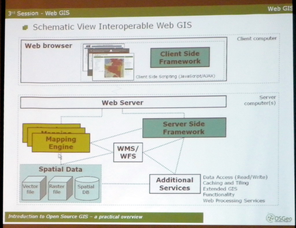
Karsten Venneman talked about a general architecture for web geospatial applications. It’s interesting that there are so many open source alternatives that a general architecture for enabling them to interoperate among themselves including mapping engines like MapServer, MapGuide, GeoServer, and others as well as with proprietary applications has become very important.

Be the first to comment