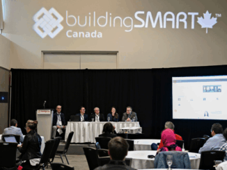
• facebook
  • Twitter
  • Linkedin
  • Youtube
  • Linkedin Group
  • Post a Job
  • Post an Ad
  • Post an Event
  • Post a Directory Listing
  • Post a Press Release
  • Media Kit
  • My Account
  • Login
GoGeomatics
  • MAGAZINE
    • BIM & GIS
    • Community
    • Conference news
    • Earth Observation
    • Education & Careers
    • GEOAI
    • Announcements
    • Reality Capture & Lidar
    • Science
    • Technology
  • Directories
    • ASSOCIATION
    • INDUSTRY
    • EDUCATION
    • Open Data
  • EVENTS
    • GeoIgnite Events
    • Events Calendar
    • GoGeomatics Meetups
  • Services
    • Advertising
    • Marketing
    • Post a Job
    • Post an Ad
    • Post an Event
    • Post a Press Release
    • Post a Directory Listing
    • Media Kit
    • Web Design
  • Find a Job
  • Volunteer
    • Start a GoGeomatics Group
    • Editors & Writers Group
  • About Us
    • About Us
    • Contact Us
    • Frequently Asked Questions
  • Videos
HomeBIM & GIS

BIM & GIS

|labour NOC|Data challenges NOC
BIM & GIS

Canada’s Blind Spot: The Government Can’t See Its Own Geospatial Sector

24 April 2025 Anusuya Datta | business

Canada’s geomatics and geospatial sector touches nearly every area of national interest — from infrastructure development and resource mapping to climate monitoring, emergency response, and public safety. It underpins smart cities, clean energy, transportation, and […]

NG911|The Transition Timeline
BIM & GIS

Canada’s Next-Gen 9-1-1: The Upgrade Depends on the Maps You Don’t See

22 April 2025 Anusuya Datta | Canada Emergency Response

When Canadians dial 9-1-1 today, they expect to speak with someone who can send help. This voice-based system has served us for decades. But major changes are coming. Canada is replacing its legacy emergency system with Next […]

|Beluga whales|Beluga Whales2|Beluga whales3
BIM & GIS

AI Meets Beluga Whales in the Arctic

17 April 2025 Anusuya Datta | AI in Conservation

Flying over Arctic waters, you’d never spot them. Beluga whales vanish against the ice below — their white bodies nearly invisible from above. Fisheries and Oceans Canada (DFO) has always watched these animals closely. For […]

Canada atlas
BIM & GIS

Canada Must Leverage Its Geospatial Legacy to Embrace New Opportunities

7 April 2025 Jon Murphy | business

How times have changed. Canada’s critical geospatial ecosystem is at a pivotal moment. For decades, our close ties with the United States have offered important strategic advantages—access to cutting-edge technologies, expansive markets, and valuable partnerships. […]

France GIS|
BIM & GIS

France’s Open-Source GIS Journey: A Blueprint for Digital Sovereignty

4 April 2025 Anusuya Datta | disaster management

A €6 billion open-source software market (as of 2022), 1,062 local authorities publishing open geodata, and a 19% year-over-year increase in government data sharing. Behind these impressive numbers lies a deliberate national strategy on part […]

bsc video
BIM & GIS

Watch This Video: Empowering the Digital Workforce at GeoIgnite 2025

2 April 2025 GoGeomatics Canada | AEC

Date: May 12-14, 2025Location: Ottawa Conference and Event Centre, Ottawa, Canada At GeoIgnite 2025, buildingSMART Canada (bSC) is hosting an exciting program track titled Empowering the Digital Workforce: Boosting Productivity with AI, OpenBIM, and Information Standards. This […]

GoGeomatics and OGC Partner for GeoIgnite 2025
BIM & GIS

GoGeomatics and OGC Partner for GeoIgnite 2025 to Advance Canada’s Geospatial Self-Reliance

25 March 2025 GoGeomatics Canada | BIM

Ottawa, ON — GoGeomatics Canada is pleased to announce a strategic collaboration with the Open Geospatial Consortium (OGC) for GeoIgnite 2025, Canada’s premier geospatial leadership conference, taking place May 12-14, 2025, at the Ottawa Conference […]

Sovereign-Data-Infrastructure|Why Sovereign Data Infrastructure is No Longer Optional for Canada|Key components of Sovereign Data Infrastructure|Why now moment for Canada|What Canada must do
BIM & GIS

Sovereign Data Infrastructure: What It Is and Why It’s Critical for Canada

20 March 2025 Anusuya Datta | AI

Data is no more just the new oil. It is a strategic asset that underpins critical infrastructure and public services. Whoever controls the data controls the future. As countries around the world increasingly move towards […]

Posts pagination

« 1 … 15 16 17 … 19 »

Events

Notice
There are no upcoming events.

View All Events

Services

  • Post a Job
  • Post an Ad
  • Post an Event
  • Post a Directory Listing
  • Post a Press Release
  • Media Kit
  • My Account
  • Login

Jobs

Post a Job
  • Canada Maps and Poster Gallery Volunteer Leads — GeoIgnite 2026
    remote
  • GIS & Data Analytics Lead
    Beaumont, AB
  • Lead Surveyor, Projects/Arpenteur-géomètre principal, projets; arpenteuse-géomètre principale, projets
    North Bay, Thunder Bay
  • Senior GIS Developer
    Calgary, AB
View All Jobs
  • Directories
    • Associations Directory
    • Industry Directory
    • Education Programs
    • Open Data
  • Volunteer
    • Start a GoGeomatics Group
    • Editors & Writers Group
  • About Us
    • GoGeomatics Media Kit
    • Who We Are
    • Contact Us
    • FAQ’s
    • Advertising
    • Marketing
  • Subscribe
GoGeomatics
GoGeomatics is the largest and most popular communications hub promoting the Canadian geospatial community. The business was incorporated in 2011. GoGeomatics hosts over 100 fun, free, location technology networking events each year in cities across Canada.

© 2025 GoGeomatics

  • facebook
  • Twitter
  • Linkedin
  • Youtube
  • Linkedin Group