• facebook
  • Twitter
  • Linkedin
  • Youtube
  • Linkedin Group
  • Post a Job
  • Post an Ad
  • Post an Event
  • Post a Directory Listing
  • Post a Press Release
  • Media Kit
  • My Account
  • Login
GoGeomatics
  • MAGAZINE
    • BIM & GIS
    • Community
    • Conference news
    • Earth Observation
    • Education & Careers
    • GEOAI
    • Announcements
    • Reality Capture & Lidar
    • Science
    • Technology
    • Between the Poles
  • Directories
    • ASSOCIATION
    • INDUSTRY
    • EDUCATION
    • Open Data
  • EVENTS
    • GeoIgnite Events
    • Events Calendar
    • GoGeomatics Meetups
  • Services
    • Advertising
    • Marketing
    • Post a Job
    • Post an Ad
    • Post an Event
    • Post a Press Release
    • Post a Directory Listing
    • Media Kit
    • Web Design
  • Find a Job
  • Volunteer
    • Start a GoGeomatics Group
    • Editors & Writers Group
  • About Us
    • About Us
    • Contact Us
    • Frequently Asked Questions
  • Videos
HomeEarth Observation

Earth Observation

Digest Oct 6
Community

International Geospatial Digest – October 6, 2025

6 October 2025 Volunteer Editors and Group Writers | climate monitoring

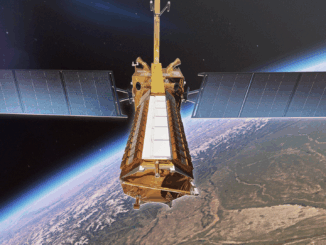
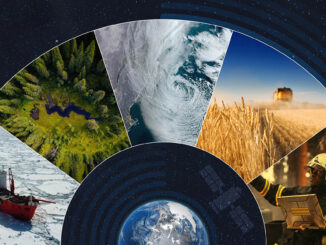
Hurricane Helene: NOAA Reflects on the Deadliest U.S. Storm Since Katrina NASA Faces Major Uncertainty Amid U.S. Govt Team Rubicon Uses GIS to Drive Disaster Response ESA’s HydroGNSS Mission to Track Global Water and Climate […]

NISAR Earth Satellite
Earth Observation

NISAR Releases First Radar Images: A New Phase Begins for the NASA–ISRO Mission

6 October 2025 Sree Vishnu Priya Donepudi | Agriculture Monitoring

A Follow-Up to July’s Anticipation As previously reported in GoGeomatics’ July 2025 International Geospatial Digest, the NASA–ISRO Synthetic Aperture Radar (NISAR) mission was launched with great anticipation as one of the most powerful Earth-observing radar […]

Canada landcover
Conference news

Earth Observation at GoGeomatics Expo 2025: Satellites for Climate and Sustainability

6 October 2025 GoGeomatics Canada | Aerial Photography

Earth Observation (EO) technologies are transforming how we monitor our planet. From climate resilience and environmental protection to resource management and industrial sustainability, EO data is providing governments, industry, and researchers with powerful insights to […]

Expo Public good
BIM & GIS

Geomatics for the Public Good: Powering Canada’s Energy & Infrastructure at GoGeomatics Expo 2025

3 October 2025 GoGeomatics Canada | asset management

As governments, utilities, and communities grapple with the demands of climate resilience, energy transition, and infrastructure renewal, geomatics is emerging as a vital enabler of these efforts. At the GoGeomatics Expo 2025, the Geomatics for the Public […]

Award winners
BIM & GIS

Final Results In: These Are the Winners of Canada’s National Geomatics Awards 2025

3 October 2025 GoGeomatics Canada | Applied Geomatics Research Group (AGRG)

The winners of the Canada’s National Geomatics Awards 2025 have been announced, recognizing leadership, innovation, and community impact across the country’s geomatics and geospatial sector. Launched to highlight outstanding contributions, the National Geomatics Awards honour […]

Community

Canadian Space Agency Launches 5 Million Dollar Satellite Biodiversity Initiative

3 October 2025 Kirstyn Howieson | AI

The Canadian Space Agency (CSA) has chosen 20 projects for funding totaling $5 million as part of its Satellite Mobilization for Biodiversity Action initiative. The program, which was first announced at the beginning of 2025, […]

BIM & GIS

WGIC Joins GoGeomatics Expo 2025; Host Horizons+ Dinner

2 October 2025 GoGeomatics Canada | Aaron Addison

GoGeomatics is pleased to announce the support of the World Geospatial Industry Council (WGIC) for the GoGeomatics Expo 2025, taking place November 3–5, 2025, in Calgary, Alberta. WGIC will host the inaugural Horizons+ World Geospatial […]

Digest Sept 29, 2025
BIM & GIS

Canadian Geospatial Digest – September 29, 2025

29 September 2025 Volunteer Editors and Group Writers | Arctic

Canada’s Defence Department Spending Millions on American Cloud Services RFI Seeks Information on Commercial SAR Imagery Acquisition Map Helps Highlight the Need to Preserve Canada’s Peatlands Industry-Government Partnership Shares RADARSAR-2 Data to Protect Rain Forests […]

Posts pagination

« 1 … 6 7 8 … 24 »

Events

Notice
There are no upcoming events.

View All Events

Services

  • Post a Job
  • Post an Ad
  • Post an Event
  • Post a Directory Listing
  • Post a Press Release
  • Media Kit
  • My Account
  • Login

Jobs

Post a Job
  • Operations Spatial Data Assistant (Contract)
    Vaughan
  • GIS Analyst
    Saint John, New Brunswick
  • GIS Student Intern
    Elmsdale, Nova Scotia
  • Canada Impact+ Research Chair – Professor (Or Associate Professor)
    Lethbridge, Alberta
View All Jobs
  • Directories
    • Associations Directory
    • Industry Directory
    • Education Programs
    • Open Data
  • Volunteer
    • Start a GoGeomatics Group
    • Editors & Writers Group
  • About Us
    • GoGeomatics Media Kit
    • Who We Are
    • Contact Us
    • FAQ’s
    • Advertising
    • Marketing
  • Subscribe
GoGeomatics
GoGeomatics is the largest and most popular communications hub promoting the Canadian geospatial community. The business was incorporated in 2011. GoGeomatics hosts over 100 fun, free, location technology networking events each year in cities across Canada.

© 2026 GoGeomatics

  • facebook
  • Twitter
  • Linkedin
  • Youtube
  • Linkedin Group