Newsmakers & Press Releases

Stantec Completes Acquisition of Dessau’s Engineering Assets

MONTREAL, QUEBEC and EDMONTON, ALBERTA–(Jan. 20, 2015) – North American design firm Stantec has significantly strengthened its presence in the…

PCI Geomatics Announces Strategic Partnership with MDA for Accessing RADARSAT-2 Imagery

MARKHAM, Ontario, Canada — PCI Geomatics, a world leading developer of remote sensing and photogrammetric software and systems, announced today…

Canadian Co. SimActive Selected by US Army Corps of Engineers for Drones

Montreal, Canada, January 13th, 2015 – SimActive Inc., a world-leading developer of photogrammetry software, has been selected by the United…

McGill Geography Researchers Map Global Impact of Dams

When dams are built they have an impact not only on the flow of water in the river, but also…

Giant Arctic Floor Map Lets Students Explore Canada’s North

Canadian schoolchildren can get a chance to “walk” across Canada’s Arctic and challenge their perceptions of the North through a…

PCI Geomatics Announces Student Licensing Availability via Partnership with Studica Academic Reseller

PCI Geomatics, a world leading developer of remote sensing and photogrammetric software and systems, today announces that it has entered…

PCI Geomatics Announces Availability of Python Scripts for use in Geomatica 2014

PCI Geomatics, a world leading developer of remote sensing and photogrammetric software and systems, today announces the availability of customized…

UrtheCast Signs Contract For $65 Million To Provide Value-Added Services and Data

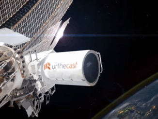
VANCOUVER, Nov. 24, 2014 /CNW/ – UrtheCast Corp. (TSX:UR) (“UrtheCast” or the “Company”) is extremely pleased to announce that it…

SimActive Correlator3D™ Chosen by ING Robotic Aviation for Image Post-Processing

Montreal, Canada, November25th, 2014 – The most important part of mapping, inspections and monitoring by robotic aircraft, is not the…

Ventus Geospatial: Canadian Company Rebrands to Gain International Opportunities

Ventus Geospatial Inc. is a leading provider of imaging gathered by unmanned aerial vehicles (UAVs) using fixed-wing planes and quad-copters.…

Hemmera Streamlines Field Data Collection and Geomatics with Flowfinity Mobile Forms

New case study from Flowfinity Wireless reveals how Hemmera significantly increased the productivity of field operations with a mobile data…

Transport Canada Announces Simpler Rules for Small Unmanned Air Vehicles

Transport Canada announced, at the Unmanned Systems Canada conference in Montréal, two exemptions that simplify small unmanned air vehicle (UAV)…