• facebook
  • Twitter
  • Linkedin
  • Youtube
  • Linkedin Group
  • Post a Job
  • Post an Ad
  • Post an Event
  • Post a Directory Listing
  • Post a Press Release
  • Media Kit
  • My Account
  • Shopping Cart
  • Login
GoGeomatics
  • MAGAZINE
    • BIM & GIS
    • Community
    • Conference news
    • Earth Observation
    • Education & Careers
    • GEOAI
    • Announcements
    • Reality Capture & Lidar
    • Science
    • Technology
    • Between the Poles
  • Directories
    • ASSOCIATION
    • INDUSTRY
    • EDUCATION
    • Open Data
  • EVENTS
    • GeoIgnite Events
    • Events Calendar
    • GoGeomatics Meetups
  • Services
    • Advertising
    • Marketing
    • Post a Job
    • Post an Ad
    • Post an Event
    • Post a Press Release
    • Post a Directory Listing
    • Media Kit
    • Web Design
  • Find a Job
  • Volunteer
    • Start a GoGeomatics Group
    • Editors & Writers Group
  • About Us
    • About Us
    • Contact Us
    • Frequently Asked Questions
  • Videos
HomeScience

Science

Earth Observation

Why a U.S. Mapping Program Is Gaining Bipartisan Support Amid Research Funding Cuts

14 April 2025 David Legris | Biden

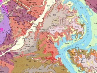
With all the drastic cuts in scientific research funding in the U.S. lately, I was surprised to learn about one program that’s actually getting support. The Earth Mapping Resource Initiative (Earth MRI), a United States […]

Community

Women in Tech: Changing the Game, Not Just Playing It

8 April 2025 Nadine Alameh | collaboration

Throughout my career, I’ve encountered many stereotypes about what women supposedly can’t do in engineering and technology. “Women aren’t analytical enough.” “Women can’t handle complex systems.” “Women just don’t think that way.” They are just […]

International-Digest-April-7||||||
Community

International Geospatial Digest for April 7, 2025

7 April 2025 Volunteer Editors and Group Writers | Arctic

Greenland Map Showing ‘Strategic Resources’ Eyed by USA, China Mapping the Destruction from the Myanmar Earthquake Apple Maps Adds More Than 250 Indigenous Placenames in Australia Stormy Rains in the Sahara Offer Clues to Past […]

Canada atlas
BIM & GIS

Canada Must Leverage Its Geospatial Legacy to Embrace New Opportunities

7 April 2025 Jon Murphy | business

How times have changed. Canada’s critical geospatial ecosystem is at a pivotal moment. For decades, our close ties with the United States have offered important strategic advantages—access to cutting-edge technologies, expansive markets, and valuable partnerships. […]

National Glaciology Project|||||||Water Canada|Columbia Basin|Nrcan water model
Community

Securing Canada’s Water Resources in a Changing World

31 March 2025 David Legris | Canada

Water is crucial for all life on Earth, and as the planet increasingly feels the effects of climate change, freshwater is becoming an even more contentious issue. Canadians are fortunate to possess approximately 20% of […]

International-Digest-March-24|||
Community

International Geospatial Digest – March 24, 2025

24 March 2025 Volunteer Editors and Group Writers | AI

Mapping Mineral Resources at Opposite Poles Australia and Greenland have long been known for their abundance of valuable natural resources. However, with changing global geopolitics and increasing headlines surrounding the two, some maps that highlight […]

Sovereign-Data-Infrastructure|Why Sovereign Data Infrastructure is No Longer Optional for Canada|Key components of Sovereign Data Infrastructure|Why now moment for Canada|What Canada must do
BIM & GIS

Sovereign Data Infrastructure: What It Is and Why It’s Critical for Canada

20 March 2025 Anusuya Datta | AI

Data is no more just the new oil. It is a strategic asset that underpins critical infrastructure and public services. Whoever controls the data controls the future. As countries around the world increasingly move towards […]

Canadian-digest-Mar-11||||
Community

Canadian Geospatial Digest – March 17, 2025

17 March 2025 Volunteer Editors and Group Writers | Canada

EarthDaily Strengthens Wildfire Monitoring with SkyForest Acquisition New Seismic Mapping Project Aims to Safeguard Metro Vancouver Tracking Herring Spawns from Space to Support Coastal Conservation Legacy of Water Diversions Still Felt in Great Lakes Communities […]

Posts pagination

« 1 … 11 12 13 … 15 »

Events

Notice
There are no upcoming events.

View All Events

Services

  • Post a Job
  • Post an Ad
  • Post an Event
  • Post a Directory Listing
  • Post a Press Release
  • Media Kit
  • My Account
  • Shopping Cart
  • Login

Jobs

Post a Job
  • Geospatial Analytical Technician / Technicien, analyses géospatiales; technicienne, analyses géospatiales
    Peterborough
  • Hydrogeologist
    Calgary, Alberta
  • Intern, Operational Technology (GIS Technologies)
    Montreal
  • Geomatics Technician(s)- Canadian Armed Forces (CAF)
    Across Canada
View All Jobs
  • Directories
    • Associations Directory
    • Industry Directory
    • Education Programs
    • Open Data
  • Volunteer
    • Start a GoGeomatics Group
    • Editors & Writers Group
  • About Us
    • GoGeomatics Media Kit
    • Who We Are
    • Contact Us
    • FAQ’s
    • Advertising
    • Marketing
  • Subscribe
GoGeomatics
GoGeomatics is the largest and most popular communications hub promoting the Canadian geospatial community. The business was incorporated in 2011. GoGeomatics hosts over 100 fun, free, location technology networking events each year in cities across Canada.

© 2026 GoGeomatics

  • facebook
  • Twitter
  • Linkedin
  • Youtube
  • Linkedin Group