• facebook
  • Twitter
  • Linkedin
  • Youtube
  • Linkedin Group
  • Post a Job
  • Post an Ad
  • Post an Event
  • Post a Directory Listing
  • Post a Press Release
  • Media Kit
  • My Account
  • Login
GoGeomatics
  • MAGAZINE
    • BIM & GIS
    • Community
    • Conference news
    • Earth Observation
    • Education & Careers
    • GEOAI
    • Announcements
    • Reality Capture & Lidar
    • Science
    • Technology
    • Between the Poles
  • Directories
    • ASSOCIATION
    • INDUSTRY
    • EDUCATION
    • Open Data
  • EVENTS
    • GeoIgnite Events
    • Events Calendar
    • GoGeomatics Meetups
  • Services
    • Advertising
    • Marketing
    • Post a Job
    • Post an Ad
    • Post an Event
    • Post a Press Release
    • Post a Directory Listing
    • Media Kit
    • Web Design
  • Find a Job
  • Volunteer
    • Start a GoGeomatics Group
    • Editors & Writers Group
  • About Us
    • About Us
    • Contact Us
    • Frequently Asked Questions
  • Videos
HomeTechnology

Technology

Education & Careers

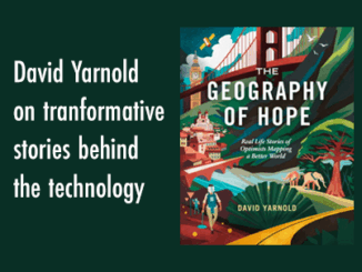
GIS Heroes in The Geography of Hope: David Yarnold on Transformative Stories Behind Technology

26 September 2024 Anusuya Datta | Book review

David Yarnold has authored many impactful stories, including the Pulitzer Prize-winning report on the 1989 Loma Prieta earthquake. As the President and CEO of the National Audubon Society, he championed environmental stewardship. In this interview, […]

Technology

Interview: How FHIMP is Strengthening Canada’s Flood Resilience Amid Rising Climate Threats

25 September 2024 Anusuya Datta | Canada Flood Map

Flooding in Canada causes an average of $1 billion in damages annually, but the summer of 2024 was especially devastating, with over $7 billion in insured losses from floods, fires, and hailstorms. As climate change […]

Technology

Canadian Geospatial Digest for September 23rd, 2024

23 September 2024 Volunteer Editors and Group Writers | 2021 Canadian Census

An online map tracks Climate-related disaster cost. University of New Brunswick researchers participate in AI-based projects Living Lakes Canada Maps helped wildfire fighters Eating disorder mapped using GIS Language map for Toronto: 54 languages mapped […]

Community

Mapping Human Footprint: Uncovering the Hidden Impact on Ecosystems in Canada

20 September 2024 Anusuya Datta | Alberta Biodiversity Monitoring Institute (ABMI)

As human activities increasingly transform ecosystems, the pressure on biodiversity across Canada is growing. The diverse geography of the second-largest country in the world — from the icy expanses of the Arctic to bustling urban […]

Technology

International Geospatial Digest for September 16, 2024

16 September 2024 Volunteer Editors and Group Writers | AI

Bentley’s Acquisition of Cesium Digital Twins Becoming Part of Everyday Life The Secret To Making Government Faster, Better, More Effective: Maps Airbus Built Sentinel-2C Satellite Successfully Launched 2024 Fall Foliage Predictions Map Bentley’s Acquisition of […]

Other

Canada’s 2023 Wildfires Released More Carbon in 5 Months Than Annual Fossil Fuel Emissions of Russia or Japan

13 September 2024 Anusuya Datta | Canada Wildfire Impact

We know Canada experienced its most destructive wildfire season ever in 2023, which single handedly drove a nearly a quarter of increase in the loss of the world’s tree cover. And now a new NASA funded study has […]

Technology

Interview: The Crucial Role of Geospatial Data and AI in Building a National Flood Strategy for Canada

10 September 2024 Anusuya Datta | Artificial Intelligence

Canada has faced a surge of extreme weather events in recent years, with devastating floods impacting communities nationwide. These events have highlighted the urgent need for comprehensive flood management and climate adaptation strategies. Joanna Eyquem, […]

Technology

Geospatial Advances Using Machine Learning and AI

9 September 2024 Peter Srajer | AI

Artificial Intelligence is complex, but understanding it is relatively simple. -Peter Srager Feed it data, give it a goal, and let it fail and fail until it figures out how to complete the task at […]

Posts pagination

« 1 … 35 36 37 … 144 »

Events

Notice
There are no upcoming events.

View All Events

Services

  • Post a Job
  • Post an Ad
  • Post an Event
  • Post a Directory Listing
  • Post a Press Release
  • Media Kit
  • My Account
  • Login

Jobs

Post a Job
  • GIS Technologist II
    Fernie, B.C.
  • GIS I TECHNOLOGIST
    Fernie, B.C.
  • Operations Spatial Data Assistant (Contract)
    Vaughan
  • GIS Analyst
    Saint John, New Brunswick
View All Jobs
  • Directories
    • Associations Directory
    • Industry Directory
    • Education Programs
    • Open Data
  • Volunteer
    • Start a GoGeomatics Group
    • Editors & Writers Group
  • About Us
    • GoGeomatics Media Kit
    • Who We Are
    • Contact Us
    • FAQ’s
    • Advertising
    • Marketing
  • Subscribe
GoGeomatics
GoGeomatics is the largest and most popular communications hub promoting the Canadian geospatial community. The business was incorporated in 2011. GoGeomatics hosts over 100 fun, free, location technology networking events each year in cities across Canada.

© 2026 GoGeomatics

  • facebook
  • Twitter
  • Linkedin
  • Youtube
  • Linkedin Group