
Peter Johnson is an associate professor in the Department of Geography and Environmental Management (GEM) at the University of Waterloo. His work is quite interesting and pertinent in this day and age. Peter studies how governments, citizens, and private companies share information through geospatial technology, including open data, the geoweb, social media, mobile devices, and the process of crowdsourcing.
Jonathan Murphy: Hi Peter. Thanks for taking the time to share a bit of your career and geomatics at Waterloo. Can you tell us a little about your interest in geography? How did you get started down the career path you have chosen?
Peter Johnson: I’m originally from the GTA and I’m also a Waterloo grad, as I did my undergraduate and masters degree here. I then went to McGill for my PhD where I worked with Dr. Renee Sieber in the Geography Department. I have loved maps ever since I was a little kid. I was fascinated by the paper topographic maps of Provincial parks where my family would camp, and also the inset maps from fiction and history books that I would read. I would spend time drawing maps of my neighbourhood and other vacations spots on sheets of graph paper. I’m not sure that I have any of those left, I think my Mom recycled them all because there were so many! I didn’t realize that I could have a career in making maps until I took an introductory cartography course at Waterloo. My mind was completely blown! At the time we were using Adobe Illustrator to make maps, but the concepts of different layers of information translated well to the intermediate course where we learned GIS with ArcView and IDRISI. I haven’t looked back since then, and I simply love the diversity of map-making technology that we now have, especially with web mapping packages.
Jonathan Murphy: You have a keen interest in Open Data, open government, GIS, and the use of AI. These topics are in the news a lot these days. What are you working on that you can share?
Peter Johnson: Right now my main focus of research is on trying to understand what the benefits are of these different technologies. How can they be used, by whom, and what are the issues or problems with implementing them. I think that these questions are important because often technologies are developed and introduced without much critical thought about how they would be used and who would benefit from them. Take social media as an example: for most of us, Twitter is seen as a fun way to communicate with people around the globe; I’m not sure too many people thought that it could be used to influence elections or other truly disruptive actions. My research tries to think ahead in time about the implications of geospatial technology and data. For example, as the government shares data, should they also be open to accepting edits and changes to that data from citizens? If I find an error in a government data set (and yes, there probably are a few), can I, as a citizen, tell the government to change it? As part of my research, I also get to work with really smart people. So for example, I am working with Dr. Teresa Scassa, a colleague in the Faculty of Law at the University of Ottawa to understand some of the legal aspects to how companies and non-profits can use government open data in their own products. We get to think about what some of the positive and negative implications are of sharing this data in terms of ownership and privacy. I also continue to work with Dr. Renee Sieber at McGill and the entire Geothink.ca team; we are working to understand some of the big issues about how spatial technology and Open Data are impacting government-citizen relations.
Jonathan Murphy: Do you get to introduce a lot of these topics in the courses you teach at Waterloo? These would have been some of the first courses I would have gone for when I was in school.
Peter Johnson: I do cover a bit about Open Data in my fourth-year course called “The Geoweb and Location-Based Services”, but as you can imagine, accessing and using data runs throughout our GIS curriculum. Waterloo students are regular users of government Open Data catalogues from around the world. For example, in my third year Advanced GIS course we have used automobile accident data from the City of Seattle to analyze emergency vehicle response times. I’ve also done this same type of assignment with local data from the Region of Waterloo Police Services. Given the number of governments that are providing open data, there really is an almost limitless number of options for cool datasets to use out there. From a technology perspective, I have a real interest in diverse toolsets and helping students realize that there is more than one GIS vendor. I try to have a focus in my courses for students to use a variety of tools, whether that is desktop GIS such as ArcMap, ArcGIS Pro, and QGIS, or web-based tools like CARTO and leaflet.
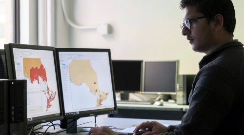
Jonathan Murphy: The geomatics program at Waterloo is a 4-year honours degree with the Department of Geography and Environmental Management. What makes the geomatics program at Waterloo special? ![]()
![]()
Peter Johnson: Our Geomatics program was built because our Geography students wanted more GIS, remote sensing, and computer science courses. So we took a geography degree and really increased the exposure to these topics. As you know, Waterloo has one of the best computer science programs in the world, so we worked with our colleagues in the School of Computer Science to allow Geomatics students to take courses that they offer. So currently our Geomatics students take four CS courses as a requirement as well as 13 Geomatics (GIS, RS, Surveying, Spatial Statistics) courses. Students can also choose to take a Computing option, accessing even more courses from the School of Computer Science. From my perspective as a faculty member and from what I see being offered elsewhere, our program has a significant focus on Geomatics content. Obviously, our Geography and Environmental Management students still take many Geomatics courses, but our Geomatics students are truly immersed in the subject from all angles.
Jonathan Murphy: How did the geomatics component of the geography program at Waterloo get started? Why geomatics?
Peter Johnson: Geomatics related research goes back to the earliest days of the Department of Geography in the early 1960s, beginning with an emphasis on photogrammetry and air photo interpretation. This research broadened and expanded through the 1960s, 70s, and 80s as satellite remote sensing and geographic information systems were developed and expanded. By the 1990s, the department was offering a robust set of 10 courses covering GIS, remote sensing, and surveying. Strong demand for these courses, combined with the rapid development of the internet and computing technologies at this time led to increasing demand for graduates who were ready to jump into this rapidly growing field. This led to an interest in developing a dedicated Geomatics program, in partnership with computer science at UW, that would prepare students not just as users of geospatial technologies, but as developers and critical thinkers as well. The original proposal for the Geomatics plan began development in the fall of 2004. Following approvals, the program began admitting students in 2007. The program has grown steadily over time and we now take in approximately 90 students in our first-year cohort.
Jonathan Murphy: How many students at the undergraduate level and the graduate level do you have in the program? What types of jobs will they be going after once they graduate?
Peter Johnson: In 2018, there were 298 undergraduate students registered in the geomatics program (229 in co-op, and 69 in the regular program). Graduates from the geomatics program end up in all sectors of the economy, all over Canada and the world, in both the public and private sectors. This can include:
- Software companies
- Consultants (engineering, planning, environmental, data management)
- Retailers
- Insurance
- Mining, petroleum, and other natural resources extraction and management
- Transportation
- Medical and health care
- Utilities
- Government at the federal, provincial, and municipal levels
Our graduate program at Waterloo (MES, MSc, and PhD) is quite robust, and we offer it in conjunction with Wilfrid Laurier University, making it one of the largest graduate schools of Geography in Canada. Since all graduate students are registered in the same geography program, it is more difficult to determine how many of these students are pursuing a thesis topic with a Geomatics component. Safe to say, there are many opportunities for interested graduate students to work with our faculty on topics related to Geomatics. Just take a look at our current research themes to see the breadth available. Being in a Faculty of Environment, we’ve linked up what we do at the research level with the United Nations Sustainable Development Goals (SDGs). I personally find it very rewarding to work in a faculty where our overall research goal is to solve some of the most pressing environmental challenges facing the world today, and of course, geomatics and geospatial technology has a significant role to play in finding those answers.
Jonathan Murphy: Waterloo has an excellent co-op program. Most undergrads don’t go on and do graduate degrees, so co-op programs are key bridges to work. What are some of the opportunities that students have been able to access through the program? What organizations have they worked with?
Peter Johnson: The Waterloo co-op program is a huge benefit to our students. At graduation, students will have almost two years of full-time, paid experience gained through a variety of jobs. I was a co-op student myself, and I feel like the entire experience, from learning how to put together a solid resume, interviewing skills, and how to handle yourself in a professional workplace was a significant career boost that set me apart from my peers. Our Geomatics co-op students are employed for a series of four-month work terms that alternate with school terms. They work in a number of different areas, including municipal, provincial, and federal departments, typically with GIS departments or federal research departments as a data analyst or GIS technician. Students might find themselves working with property data or remotely sensed imagery. Students also work with the private sector, including engineering firms, real estate or location service companies, and even at geo-related startups in the Kitchener-Waterloo tech sector. Example co-op jobs include:
- Software Quality Assurance, Safe Software
- IT Intern, Zayo Group (Telecommunications Infrastructure)
- GIS Analyst, Buchanan Associates
- Geomatics Technician, Syncrude Canada Ltd.
- GIS Technician, Statistics Canada
- Data Analyst, Natural Resources Canada
- GIS & Data Management Student, The Regional Municipality of Halton
- Student Analyst-GIS, City of Toronto
Jonathan Murphy: On the technical side, what software and hardware are you using to teach with? Do you have dedicated “geo” labs or are students working off their own laptops?
Peter Johnson: At Waterloo, we have long had several dedicated computer labs with a wide variety of GIS and image processing software. Our introductory course now uses QGIS and is also offered online, which is really helping to draw students from other areas into Geomatics. Additionally, many students find that they use QGIS when on a work term at their co-op employer, so it is great that they have early experience using this software. Our second-year course uses the popular ArcMap package, and we are using ArcGIS Pro for our third-year course. Again, students in the co-op program gain additional experience using these software packages in the real world, with actual workflows. In this way, their four-month co-op becomes the best ‘geo’ lab they could ever have access to! I feel that this type of practical hands-on experience is a huge boost for their skill level, with the sheer number of hours of use gained on co-op helping students progress to expert level very quickly. From the RS perspective, we use ENVI and PCI Geomatica. Our Databases course uses Oracle and PostgreSQL. Many of our courses emphasize coding and command-line interaction with various spatial analysis packages, so students can also expect to become familiar with Python, R, and Javascript.
In most course environments, students are also welcome to use their own laptops. We have site licensed options for installing most software packages, and students can also access a virtual machine if they wish. That being said, I always recommend that students work in the labs – the chairs are comfy, many labs have dual displays, and the machines are significantly faster than any commercial laptop. You also don’t have to worry about how your roommate streaming Netflix is slowing down your Internet connection! Additionally, there is the experience of working through assignments with your classmates and teaching assistant that can only happen when you are co-located in the lab!
Jonathan Murphy: Students are able to customize their degrees. What are the options for that?
Peter Johnson: Geomatics students can add options, diplomas, minors, or joint majors to their degree. Options that can be added to the degree include Computing, Business, Parks, and Tourism. Available diplomas include Sustainability, Ecological Restoration and Rehabilitation, Environmental Assessment. A student may minor in another program of study at UW, or complete a joint honors degree with another program. I like to say in class that no two Geomatics degrees are the same, and I honestly think that’s true. University is a great place to explore different topics of interest, and whatever you are interested in can probably be fit into your degree.
Jonathan Murphy: Peter thanks for taking the time to tell us about your work and the many opportunities students have at Waterloo. We hope that you will update us on your work in regards to open goverment and data.


Be the first to comment