
As Canada embarks on one of its most ambitious infrastructure build-outs in decades, Desert Creative Group (DCG), a Twin Falls, Idaho–based geospatial technology and strategy firm, is expanding north to bring advanced positioning tools to Canadian professionals. As the Master Distributor for Tersus GNSS across North America, DCG represents a new wave of accessibility and performance in precision technology.
Founded in 2014 and headquartered in Melbourne, Australia, Tersus GNSS has been a pioneer in centimeter-accurate positioning technologies. Its solutions support a wide range of applications including UAVs, surveying, mapping, precision agriculture, construction, engineering, deformation monitoring, and autonomous vehicles. In partnership with DCG, Tersus manages distribution throughout North America, with DCG overseeing inventory and order fulfillment, building and supporting a reseller network, providing tier-one technical support, and assisting with strategic solution integrations. Together, the two companies are expanding access to affordable, high-precision solutions designed to strengthen the foundation of Canada’s infrastructure transformation.
In this exclusive interview, Janeale Dean, President of DCG, shares how this collaboration is helping professionals access high-accuracy, resilient, and affordable solutions — and outlines DCG’s plans to support Canada’s ongoing infrastructure build-out.
DCG will also be showcasing the full Tersus GNSS portfolio at the GoGeomatics Expo 2025 in Calgary this November.
For readers unfamiliar with DCG, could you please introduce the company and explain its role in the geospatial ecosystem?
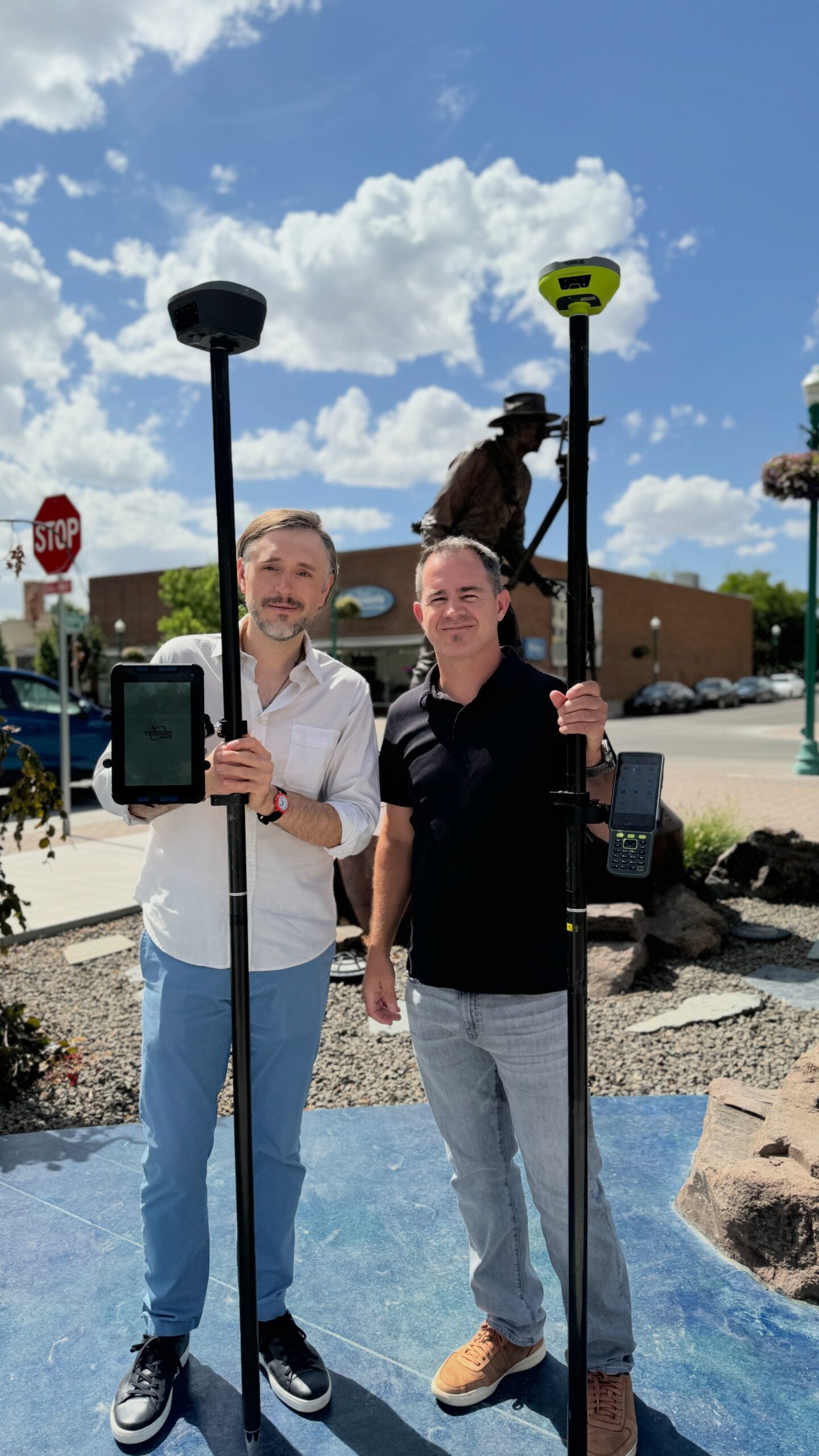
Desert Creative Group (DCG) is a multidisciplinary firm specializing in geospatial technology, business strategy, and creative marketing. With over 100 years of combined experience, our team blends deep technical expertise in GNSS, LiDAR, photogrammetry, and GIS with strategic consulting and brand development tailored to the geospatial sector.
DCG is the Master Distributor for Tersus GNSS across the U.S. and Canada. We manage sales, logistics, dealer recruitment and enablement, and marketing initiatives, while providing consultative support and workflow integration to resellers and end-users. Our mission is to empower the industry with tools, training, and insight that make precision technology more accessible and impactful, both in the field and in the marketplace.
This is your first time joining the GoGeomatics Expo. Why was now the right moment to expand into Canada?
Canada is at an inflection point with investing heavily in digital infrastructure, smart cities, and sustainable resource management. The timing is ideal for DCG and Tersus to contribute technologies that make precision data capture more accessible. Our expansion brings affordable, high-performance GNSS, LiDAR, and bathymetric solutions to Canadian professionals, backed by local reseller partnerships and our commitment to long-term support.
The GoGeomatics Expo is the perfect platform to build those relationships and showcase how next-generation tools like the Oscar Trek, Geobee, MVP S2 slam system, and The Duck USV can accelerate digital transformation across Canada’s infrastructure ecosystem.
Canada has recently made historic commitments to infrastructure and digital transformation. From your perspective, what role can geospatial and GNSS technologies play in that build-out?
Infrastructure decisions start with location. From assessing needs and site selection to evaluating impact and guiding improvements, spatial context drives understanding and clearer foresight. GNSS, LiDAR, and related spatial technologies are the backbone of Canada’s digital future, empowering the design of resilient utilities, sustainable transportation networks, and smarter environmental systems for generations to come. Accurate, repeatable, and accessible positioning data enables engineers, surveyors, and GIS professionals to collaborate in real-time, reduce rework, improve safety, and ensure data integrity across every stage of the infrastructure project and operational lifecycle.
Positioning resilience is becoming increasingly critical for the construction, utilities, and public safety sectors. How do you see DCG and Tersus contributing to these national priorities?
Resilience starts with reliable data, and that’s exactly what Tersus delivers! Together, DCG and Tersus are helping organizations enhance their spatial resilience by combining affordability, performance, and flexibility, ensuring that critical infrastructure projects can continue to operate regardless of conditions or budget.
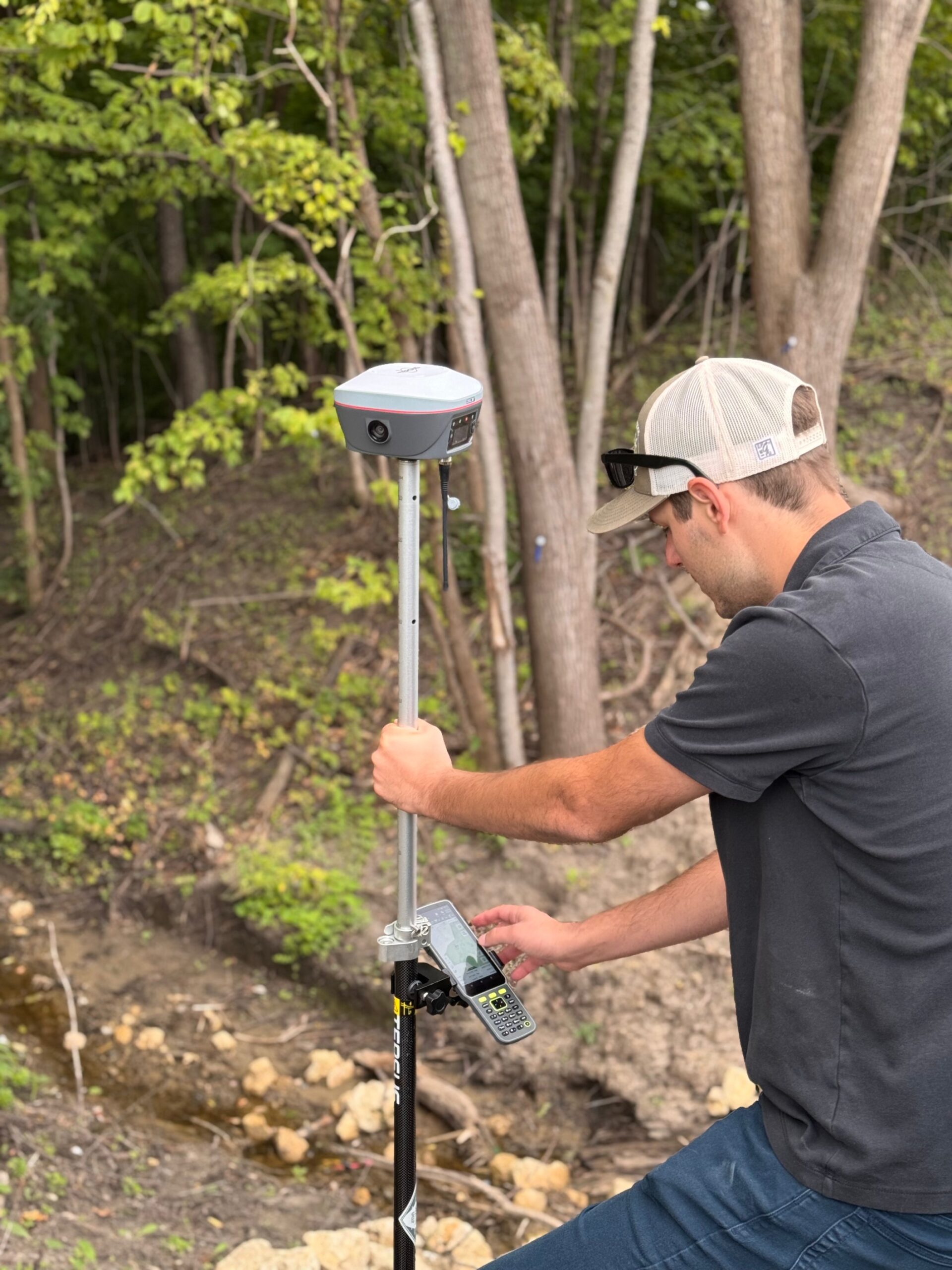
The GeoBee, for example, provides cost-effective, permanent base station infrastructure for delivering real-time corrections. Meanwhile, receivers like the Luka and Oscar Ultimate ensure dependable, high-accuracy positioning even in challenging and remote environments.
What unique challenges or opportunities do you see in Canada’s infrastructure environment compared to the U.S. market?
Canada’s vast and varied geography presents both obstacles and opportunities, including many remote and rural projects that lack access to established RTK or network correction services. Tersus’s technology offers solutions for these scenarios, supporting a wide array of processes, applications, and needs across a range of devices. The Oscar Trek, for example, can be integrated into drone workflows for aerial missions to capture ground control or used for real-time positioning and post-processing GNSS data. The same product can be used with robust applications like Esri’s ArcGIS Field Maps for high-accuracy positioning, or you can utilize the internal camera for environmental documentation and data capture, creating a digital record and twin. The Canadian geospatial community is collaborative and forward-thinking, readily adopting new technologies that enhance efficiency and accessibility, making it an ideal environment for innovation without excessive cost.
DCG is the Master Distributor for Tersus GNSS across the U.S. and Canada. How did this partnership develop, and what makes it unique?
Our partnership with Tersus is founded on a mutual dedication to making advanced positioning technology accessible to all and prioritizing customer needs in all decisions. This alignment of values quickly led to the formation of our strong partnership. Tersus drives innovation by independently developing its own GNSS Boards and RTK engines, thereby eliminating the middleman and reducing costs. This approach enables them to offer compact, high-performance, and fully featured receivers that redefine the GNSS industry.
DCG complements Tersus’s innovation with extensive technical consulting, backed by decades of proven field and industry experience, workflow validation, and geospatial strategy and thought leadership. Together, we deliver more than just hardware as we work closely with our customers to listen attentively and help solve the complex challenges that others often overlook. We believe that through collaborative effort, we all become more knowledgeable, resolve challenges more efficiently, and grow through shared experiences.
What differentiates Tersus GNSS solutions — such as Oscar Trek RTK, TAP PPP, or The Duck USV — in terms of value for infrastructure and industrial projects?
Tersus solutions are engineered for performance and versatility while remaining cost-effective. The Oscar Trek combines RTK, Tilt capabilities, and visual positioning to capture georeferenced imagery, extract points directly from photos, and generate point clouds in the field without additional software.
TAP Precise Point Positioning (PPP) delivers centimeter-level accuracy within minutes, even in remote Canadian regions where traditional RTK networks are unavailable.
The Duck USV transforms bathymetric mapping with a compact, single-person-operated autonomous platform for high-resolution underwater data collection.
Together, these solutions provide surveying, construction, utilities, and environmental professionals with unmatched accuracy, efficiency, and flexibility across every stage of a project.
Innovations like visual positioning are gaining momentum across the industry. How do you see these technologies changing workflows in areas such as surveying, mapping, and infrastructure inspection?
3D visualization and analysis are revolutionizing project workflows from initial concept to design, permitting, construction, as-built documentation, and infrastructure operations management. Visual positioning and SLAM (Simultaneous Localization and Mapping) technologies are revolutionizing the capture of spatial data. Devices like the Oscar Trek, which derive 3D data from imagery, empower anyone to collect richer contextual data faster and more safely. This goes beyond simple map points, allowing for the creation of comprehensive digital twins and bringing visual validation and real-world understanding back to the office. When combined with LiDAR systems such as the MVP-S2 SLAM system and MVP-400 LiDAR, and supported by precise GNSS positioning, visual workflows provide unprecedented situational awareness that was previously unimaginable.
Can you share one or two North American deployments where Tersus solutions delivered measurable improvements (e.g., accuracy, time saved, cost avoided)?
 We’ve seen dramatic improvements across multiple sectors. For instance, in large-scale municipal infrastructure projects in Colorado and Minnesota, users require a survey-grade solution for CAD stakeout and working with surfaces to ensure accurate elevations. At the same time, they need the capability to utilize this same positioning technology with extensive enterprise deployments of ArcGIS Field Maps for as-builting purposes. Solutions like Luka and Oscar provide the ease of use and flexibility to meet the needs of the modern geospatial professional’s varying workflows and day-to-day field initiatives.
In Georgia, a local survey firm was contracted by the county GIS department on a crucial project to reestablish historical county lines across the challenging, heavily forested terrain. The team utilized Tersus’s PPP to establish a reference frame. Then, using Tersus’s advanced RTK engine, the team achieved centimeter-level accuracy, even under dense tree canopy. This collaboration yielded significant benefits, including strengthened working relationships between GIS and survey teams, measurable improvements in efficiency and data quality, and cost savings for both the surveying firm and the municipality compared to using conventional techniques. This project sets a new standard for how counties can collaborate to resolve complex surveying challenges.
Which workflows and platforms do you integrate with (e.g., major GIS/CAD/BIM), and what standards/networks in Canada (PPP/RTK) do you support?
Tersus’s solutions can integrate with leading GIS and CAD platforms, including Bentley Systems, AutoCAD, and Esri GIS. Tersus Nuwa software, for instance, supports industry-standard file formats such as CSV, SHP, LandXML, LAS, and DXF, facilitating easy data sharing across various business systems. The MVP (Meta Verse Painter) LiDAR solutions use common file formats, including LAS, LAZ, and E57.
They also support additional software workflows with ArcGIS Field Maps, Survey123, QuickCapture, and Micro Survey Field Genius, among other apps.
Tersus has its own PPP solution, as well as complete support for all industry-standard NTRIP protocols.
All Tersus smart receivers come fully equipped with all communication layers that include wifi, cellular, UHF (Tx/Rx), and serial data. This enables broadcasting corrections through Tersus’s cloud-based GeoCaster service, giving users both radio and internet-based correction options. Think of it as solutions for any environment that supports GNSS workflows.
Without pre-announcing products, what capabilities or priorities can Canadian customers expect DCG/Tersus to emphasize over the next 12–18 months?
Tersus and DCG are currently working on developments that will change the way we think about sensor stacking, workflow usability that we’ve all become accustomed to, and the limits of high-accuracy positioning. It’s going to be a big year ahead.
What opportunities and challenges do you anticipate as you build partnerships and expand your reseller network in Canada?
The greatest opportunity lies in collaboration. Canada’s geospatial community is both technically skilled and eager to innovate, which aligns perfectly with DCG’s consultative approach.
Finally, what message would you like to share with Canadian geospatial professionals as you enter this market at such a pivotal moment?
Our message is simple: precision doesn’t have to be complicated or expensive.


Be the first to comment