
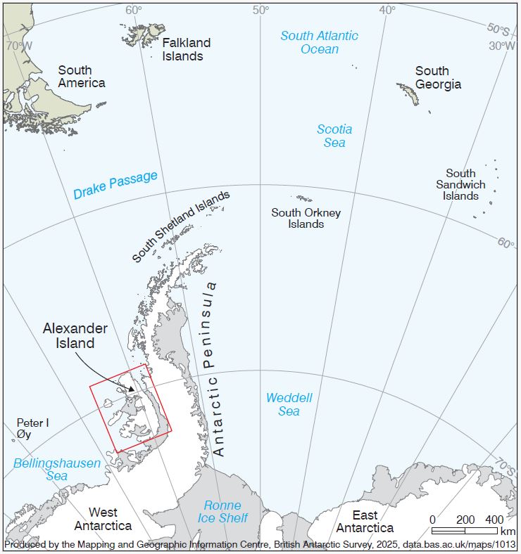
Down in the icy waters of the Bellingshausen Sea, just off the west coast of the Antarctic Peninsula, there’s this massive chunk of land called Alexander Island. It’s actually the biggest island in Antarctica, although for a long time people thought it was part of the mainland. It’s separated by a frozen channel called George VI Sound, but the George VI Ice Shelf bridges that gap, connecting it back to the peninsula like a frozen footpath. Despite its size, not many people know about it.
For over two centuries, our understanding of Alexander Island remained patchy because of outdated maps. The first mapping efforts came in 1959, carried out by the Falkland Islands Dependencies Survey, the precursor to today’s British Antarctic Survey (BAS). In 1980s new maps came out, but those soon fell behind the rapid pace of glacial change. Now, in 2025, a new chapter unfolds.
Animation showing the difference between the old and new topographic maps made by MAGIC. Source: BAS
The Mapping and Geographic Information Centre (MAGIC) at BAS has just unveiled two new state-of-the-art maps, one capturing the topography, the other the geology.
These two maps reveal what was once hidden beneath snow and shadow. Towering Mount Hall, now confirmed as the highest point at 3,078 meters, replaced the long-thought tallest, Mount Stephenson. They also chart the retreat of glaciers and the encroachment of climate change on Antarctica’s icy skin.
The geological map digs into deep layers. it weaves together layers of sediment, fossil beds, and tectonic tales that link Alexander Island to the broader narrative of West Antarctica’s formation. It’s based on research going all the way back to 1936, with most of the heavy lifting done between the ’60s and ’90s, when teams of geologists braved tough conditions to study the island’s layered rock formations. This geological map pulls together decades of fieldwork and finally gives us a full picture of how Alexander Island formed, tying it into the bigger story of West Antarctica.
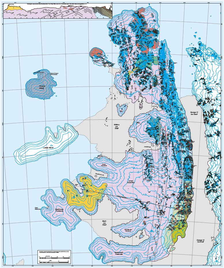
The new topographic map lays out everything from coastlines and ice shelves to mountain heights and rocky outcrops in a very clear and easy to read format. Alexander Island is home to massive mountain ranges, some over 3000 m tall. Using satellite data, the team discovered that Mount Hall, not Mount Stephenson, is actually the island’s highest peak at 3078 m.
The map also tracks changes to nearby ice shelves, especially the Wilkins Ice Shelf, which has been shrinking fast. It used to be connected to Charcot Island by an ice bridge, but that broke off in 2009 and the ice has been retreating ever since. The map captures the shelf’s extent as of late 2024, but with how fast things are changing, parts of it are already outdated. just the reality of mapping Antarctica!
with these new maps, Alexander Island isn’t just a frozen landmass anymore. it’s a dynamic, evolving landscape full of surprises. with Antarctica changing faster than ever, keeping maps like these up to date is more important than ever.
Large-format prints are available for researchers, educators, and polar enthusiasts through British Antarctic Survey (BAS).


Be the first to comment