Hello, GoGeomatics community!
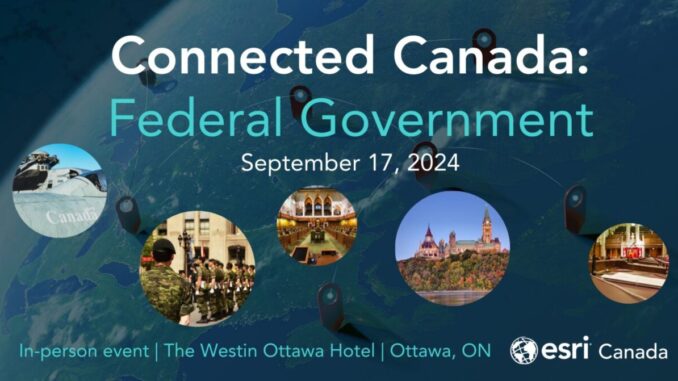
I’m Farzaneh, and I’m excited to share some key highlights from the Connected Canada event, held on September 17, 2024, for the Federal Government at the Westin Hotel in Ottawa, hosted by Esri.
With experience working across both government and private sectors on GIS solutions and business assessments, I’m passionate about GIS projects. I knew this event would be a valuable opportunity to engage with GIS leaders and learn about the latest technologies shaping federal government initiatives.
In this post, I’ll share the main takeaways from the event to give you a glimpse of what happened and help you connect with the presenters.
At the Connected Canada event GIS professionals, data scientists, and industry leaders all attended to explore the integration and application of Geographic Information Systems (GIS) in the federal government. While there have been other “Connected Canada” events across the country, the Connected Canada Federal Government event was likely the largest Esri Canada has hosted since COVID. This is due to the size of the federal community and the event’s location in Ottawa, which made this event especially rewarding. The day was filled with lots of opportunities for networking, insightful discussions, and showcases of GIS technology, and I’m happy to share my experience.
Morning Sessions: Laying the Groundwork
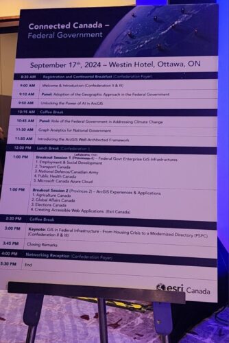
The event started off with a warm welcome by Jeff Huges, District Manager at ESRI, and was quickly followed by a panel discussing the “Adoption of the Geographic Approach in the Federal Government” by Julie Leese and Alex Miller. It was impressive to see how GIS has been embedded into government systems, which highlights a shift towards more data-driven decision-making processes.
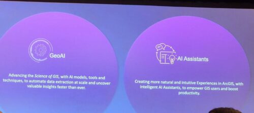
In the next session, “Unlocking the Power of AI in ArcGIS,” Lexxi Clement and Ravz V. showcased the integration of AI with GIS and how AI enhances spatial analysis and brings data processing and visualization techniques into the sectors.
This integration was a huge step in GIS technology, allowing us to automate complex analytical tasks that traditionally required significant manual effort. For example, AI can quickly analyze large datasets to detect and classify objects and identify patterns, or anomalies that would be difficult for human analysts to recognize quickly. This capability is especially useful in areas such as environmental monitoring (e.g. damage assessment), urban planning, and emergency management, where quick data analysis can inform critical decisions. Moreover, several case studies where AI-driven GIS tools have already made impactful contributions were showed. These examples provided tangible insights into how federal agencies can leverage AI-enhanced GIS to improve service delivery, policy-making, and operational efficiencies. By integrating AI with GIS, the federal government can not only improve its analytical capabilities but also enhance its responsiveness to dynamic challenges.
This discussion set the stage for a tech-driven day, emphasizing on innovation in the federal sector.
Addressing Global and Local Challenges
Mid-morning sessions included an important panel on the “Role of the Federal Government in Addressing Climate Change” by Mike Ballard, Public Safety Canada.
It was a detailed discussion on how GIS technology is helping to address environmental issues, from tracking deforestation and pollution levels to sustainable urban planning.
Graph Analytics for National Government
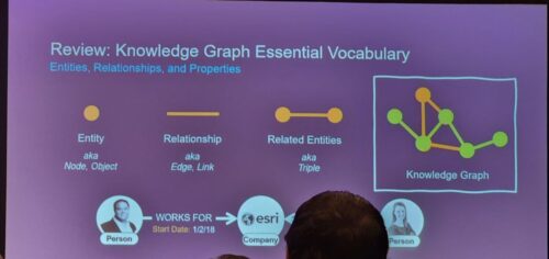
Tim Murphy and Amy Clarke presented an insightful session on “Graph Analytics for National Government”. It opened my eyes to the capabilities of ArcGIS Knowledge—a platform designed to enhance how government analysts, data scientists, and GIS professionals handle and interpret complex data. This tool is a big step forward in data processing and visualization, making it easier to connect and analyze different types of information.
Tim and Amy showed how ArcGIS Knowledge could be used to manage and analyze data in ways that traditional databases cannot. For example, by using graph databases, analysts can see how pieces of information interact with each other in a network instead of viewing them as isolated data points. This function is important for things like national security analytics, social services and environmental management, where understanding the links between data can improve outcomes.
ArcGIS Knowledge can be used in a wide range of government operations. It could be used in public safety, where linking data about people, places, and events can help in planning and response management. It also helpful in environmental monitoring by connecting data on pollution, weather conditions, and land use to better understand environmental impacts.
Afternoon Breakouts and Keynote Insights
After lunch, the breakout sessions were more specific. I went to the first session focusing on Federal Government Enterprise GIS Infrastructures, there I learned about how various departments like Employment & Social Development and Public Health Canada are innovating through GIS.
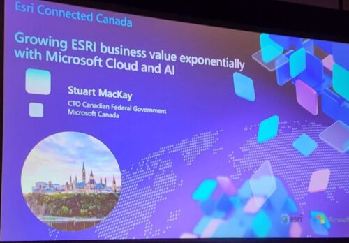
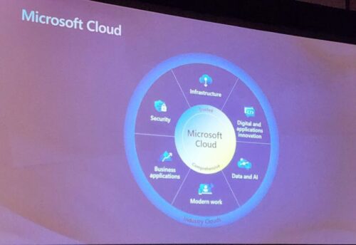
One of the standout presentations in that session was by Stuart MacKay, who covered the integration of Microsoft technologies with GIS infrastructures. His discussion highlighted how Microsoft’s cloud solutions, specifically Azure, are being used to improve the capabilities of GIS within the federal government. His presentation emphasized the scalability, security, and efficiency that Azure brings to GIS applications which is a key for managing big datasets and complex analysis.
Closing Thoughts
The day wrapped up with thoughts on how GIS is more than just a tool. It is a key part in modern governance driving data interpretation and decision-making at different levels.
As the day ended, the networking session was filled with ideas on potential collaborations and projects that could come out from the day’s discussions. I had a chance to connect to Jeff Hughes, District Manager at ESRI, and ask about the main goal behind organizing the event. “We want to help to “Connect” the Federal Government geospatial technology community and provide a “place” to discuss relevant topics and challenges. There is a bit of unique language when we discuss GIS Systems in the federal government, and I think you could hear this “talk” throughout the amazing user presentations and the networking opportunities throughout the day. Laying the foundation for solid and efficient geospatial systems in the federal government can support thousands of business units across the Government of Canada meet their unique challenges.” Jeff explained.
As GIS is developing rapidly, it’s clear that its use in government will only grow, leading to more effective and smarter strategies in policymaking and administration. I can’t wait to see where these innovations and changes will take us in the coming years and how they will revolutionize governance and public involvement.
For those who missed the event or wish to explore more about GIS applications in the federal context, I encourage you to connect with the presenters and organizers. It’s just getting started and opportunities are unlimited.


Be the first to comment