2020
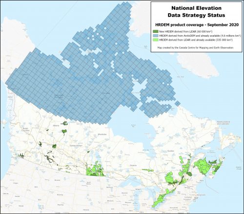
NATIONAL ELEVATION DATA STRATEGY UPDATE
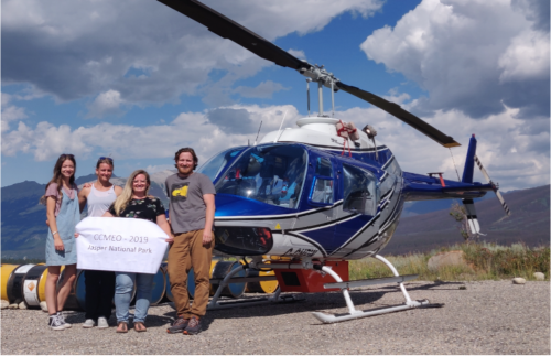
July 2020 STATUS OF THE LIDAR ACQUISITIONS The National Elevation Data Strategy team of the Canadian Centre for Mapping and…
Adapting your Geospatial job search during COVID
Landing your dream geospatial job can be hard. There is a lot of competition for geospatial job openings which has…
Diversity + Inclusion = Better Decisions: The Canadian Geospatial Sector
The GeoIgnite Conference and our sponsors are proud to present the second Diversity Leadership panel. Our inaugural Summit in 2019…
Eric Loubier -DG- CCMEO Keynote Announcement GeoIgnite 2020 Online
The GeoIgnite conference committee is excited to announce our keynote is the Director General, Eric Loubier, Canada Centre of Mapping…
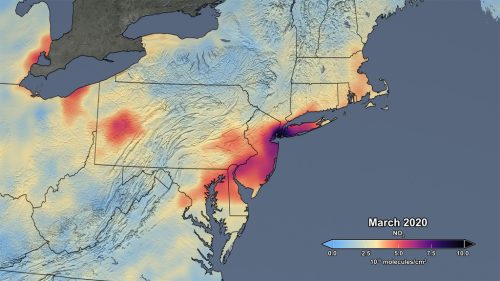
Mapping air pollution: a momentary shift due to COVID-19
COVID-19 and the resulting economic shutdowns and physical distancing measures have presented us with a peek at what it takes…
Student Opportunities with Canadian Cartographic Association
The Canadian Cartographic Association (CCA) wishes to bring to your attention several opportunities for geospatial students. Every year the CCA announces…
CANADA’S NATIONAL ELEVATION DATA STRATEGY UPDATE
November 2019 HRDEM FOR THE ENTIRE CANADIAN ARCTIC! In August, Natural Resources Canada (NRCan) made available a new release of the High…
2019-2020 Back to School Socials in Pictures – Thank you Sponsors & Participants!
The 6th annual GoGeomatics 2019 Back to School Socials have been a tremendous success. After coming off the success of…
Canada Takes Part: Arctic Spatial Data Infrastructure Meets in Anchorage
The Arctic SDI Board, which includes mapping executives from Canada, Kingdom of Denmark, Finland, Iceland, Norway, Russia, Sweden and the…
Global GIS Market to Grow Steadily at a CAGR of More Than 10% by 2020
Technavios market research analyst predicts the global GIS market to grow steadily at a CAGR of more than 10% by…
SaveTheMap Campaign: What is the future of geospatial information in India
SaveTheMap Campaign: “to encourage citizens and startups to use geospatial data in everyday lives and create businesses that serve India”…
BCIT GIS Survey: should we offer a new type of GIS program?
The BCIT GIS department is undertaking a needs assessment to determine the feasibility of offering an Advanced Certificate in GIS…


