Advertise with us
  • Support
  • Subscribe
  • Find a Job
  • Volunteer
  • Login
  • Community
  • Education & Careers
  • Technology
  • Newsmakers
  • Associations
  • Education Programs
  • Event Calendar
  • GoGeomatics Meetups
  • Open Data
  • Support
  • Subscribe
  • Find a Job
  • Volunteer
  • Login
  • Community
  • Education & Careers
  • Technology
  • Newsmakers
  • Associations
  • Education Programs
  • Event Calendar
  • GoGeomatics Meetups
  • Open Data

Aerium Analytics

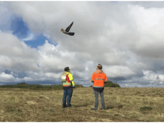
Canadian Geospatial Briefing Feb. 21st: 1. Interactive tool for avalanche risk. 2. Using drones to reforest. 3. Global glacier retreat measured. 4. Drone imitating the peregrine falcon. 5. Communities growing and shrinking in Alberta. 6. Wyvern receives funding for hyperspectral imaging.

Avalanche Canada issues special warning for B.C. and Alberta Avalanche Canada and Parks Canada had issued an advisory for many…

Marketing

  • Post a Job
  • Post an Event
  • Post a Banner Ad
  • Post a Press Release
  • Become a GoGeomatics Community Sponsor
  • Support The GoGeomatics Community
  • Login
  • About Us
    • Contact Us
    • Start a GoGeomatics Group
    • Editors & Writers Group
    • Terms of Use
    • FAQ’s
  • Magazine
    • Community
    • Education & Careers
    • Technology
    • Newsmakers & Press Releases
  • Resources
    • Associations
    • Education Programs
    • Event Calendar
    • Open Data
    • GoGeomatics Meetups
  • Services
    • Career Coaching
    • Geospatial Career Seminar Service
    • Resume & Cover Letter Writing
  • Marketing
    • Our Clients
    • Advertising
    • Marketing
    • Writing Services
    • Web Design

Connect

Newsletter Signup

GoGeomatics is the largest and most popular communications hub promoting the Canadian geospatial community. The business was incorporated in 2011. GoGeomatics hosts over 100 fun, free, location technology networking events each year in cities across Canada.

© 2022 GoGeomatics