air quality

International Digest Nov 18

International Geospatial Digest for November 18th, 2024

1.) Many Geospatial Inventions Included in TIME’s 2024 List of Top 200 Inventions 2.) Satellite Imagery Can Identify Plastic on…

International Digest Sept 11

International Geospatial Digest September 11th, 2023

Planning Landmine clearances with UAV LiDAR Mapping pollution from space Tracking dangerous chemicals in the Great Lakes with maps New…

Canadian Geospatial Digest June 12, 2023

Canadian Geospatial Digest June 12th, 2023

Canadian wildfires, Smoke map, hotspot map, fire intensity, and more An immense underwater mountain off the coast of British Columbia…

Canadian Geospatial Digest May 29, 2023

Canadian Geospatial Digest May 29th, 2023

Why are hazard maps still lacking in NWT communities? Alberta wildfires are depicted on a digital map in near real-time.…

International Geospatial Digest May 8th, 2023

US neighborhoods with more people of color suffer worse air pollution European Space and Telecoms Players Sign Partnership Agreement Climate…

GoodScore.City: Comparing the Environmental Health of Canada’s Downtown Cores

The Canadian Urban Environmental Health Research Consortium (CANUE) is a group dedicated to understanding urban living and its impacts on…

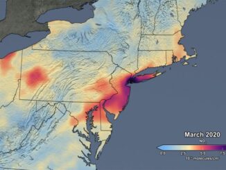
Mapping air pollution: a momentary shift due to COVID-19

COVID-19 and the resulting economic shutdowns and physical distancing measures have presented us with a peek at what it takes…