• facebook
  • Twitter
  • Linkedin
  • Youtube
  • Linkedin Group
  • Post a Job
  • Post an Ad
  • Post an Event
  • Post a Directory Listing
  • Post a Press Release
  • Media Kit
  • My Account
  • Login
GoGeomatics
  • MAGAZINE
    • BIM & GIS
    • Community
    • Conference news
    • Earth Observation
    • Education & Careers
    • GEOAI
    • Announcements
    • Reality Capture & Lidar
    • Science
    • Technology
  • Directories
    • ASSOCIATION
    • INDUSTRY
    • EDUCATION
    • Open Data
  • EVENTS
    • GeoIgnite Events
    • Events Calendar
    • GoGeomatics Meetups
  • Services
    • Advertising
    • Marketing
    • Post a Job
    • Post an Ad
    • Post an Event
    • Post a Press Release
    • Post a Directory Listing
    • Media Kit
    • Web Design
  • Find a Job
  • Volunteer
    • Start a GoGeomatics Group
    • Editors & Writers Group
  • About Us
    • About Us
    • Contact Us
    • Frequently Asked Questions
  • Videos
Homebathymetry

bathymetry

Conference news

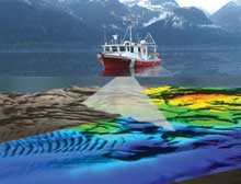
Building Canada’s Marine Data Infrastructure: Insights from GeoIgnite 2025

2 June 2025 Benedicta Antwi Boasiako | bathymetry

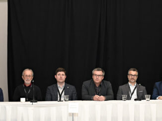
As Canada expands its vision for the Blue Economy and accelerates its digital transformation, hydrospatial intelligence is no longer a niche domain — it’s fast becoming foundational. On May 14, 2025, at GeoIgnite 2025 in […]

International Digest April 21||||
Community

International Geospatial Digest – April 21, 2025

21 April 2025 Volunteer Editors and Group Writers | AI

Meet Biomass, the Satellite Measuring the Carbon Content of Rainforests Google and AI – Geospatial Reasoning Mapping Seagrass Along the Italian Coast with Airborne Lidar Bathymetry Idea to Capture Vanguard-1, a Satellite from 1958 Senegal […]

Community

Exploring the Future of Hydrospatial Technologies at GeoIgnite 2025

14 April 2025 GoGeomatics Canada | Autonomous Survey Vessels

Hydrospatial technologies are increasingly becoming critical in addressing some of the most pressing environmental and safety challenges. From managing flood risks and monitoring coastal areas to improving maritime navigation and supporting climate resilience, hydrospatial data […]

|
Earth Observation

Seeing What Lies Beneath: Seafloor Mapping in a Marine Protected Area

7 April 2025 Benedicta Antwi Boasiako | bathymetry

When people think of conservation, they often imagine forests, wildlife reserves, or coral reefs. But what about the deep, quiet stretches of ocean that we know almost nothing about? That’s exactly what makes Ascension Island […]

Community

Charting Canada’s Waters: A Conversation with the Hydrographer General

17 February 2025 Kruti Mehta | AI

Hydrography is a cornerstone of safe and efficient navigation in Canada’s vast and complex waterways. From charting the world’s longest coastline to adhering to international maritime standards, the Canadian Hydrographic Service (CHS) ensures maritime safety […]

Technology

Mapping the Deep: Our map of the ocean remains a work in progress

25 July 2024 Jake MacLean | autonomous mapping

These days, when you look at Google Maps, Google Earth, or other web maps you are probably left with the impression that most of the world’s ocean is well mapped. You can see large mid-ocean […]

Community

Hydrospatial Advances Program For National Expo Announced

23 July 2024 GoGeomatics Expo | AI

A new program within the expo is the Hydrospatial program.  Here are the first talks announced. More to come! KEYNOTE: Alberta’s Flood Hazard and Fluvial Hazard Identification Initiatives The Government of Alberta’s Flood Hazard Identification […]

Community

Water in Focus: Hydrospatial Advances at Canada’s National Geomatics Expo

12 April 2024 GoGeomatics Canada | bathymetry

Join us as we chart the course for a resilient water future, leveraging the power of geomatics and fostering collaboration among experts across disciplines. When: October 28-30, 2024 | Calgary, Alberta, Canada Where: The Big […]

Posts pagination

1 2 … 5 »

Events

Notice
There are no upcoming events.

View All Events

Services

  • Post a Job
  • Post an Ad
  • Post an Event
  • Post a Directory Listing
  • Post a Press Release
  • Media Kit
  • My Account
  • Login

Jobs

Post a Job
  • Canada Maps and Poster Gallery Volunteer Leads — GeoIgnite 2026
    remote
  • GIS & Data Analytics Lead
    Beaumont, AB
  • Lead Surveyor, Projects/Arpenteur-géomètre principal, projets; arpenteuse-géomètre principale, projets
    North Bay, Thunder Bay
  • Senior GIS Developer
    Calgary, AB
View All Jobs
  • Directories
    • Associations Directory
    • Industry Directory
    • Education Programs
    • Open Data
  • Volunteer
    • Start a GoGeomatics Group
    • Editors & Writers Group
  • About Us
    • GoGeomatics Media Kit
    • Who We Are
    • Contact Us
    • FAQ’s
    • Advertising
    • Marketing
  • Subscribe
GoGeomatics
GoGeomatics is the largest and most popular communications hub promoting the Canadian geospatial community. The business was incorporated in 2011. GoGeomatics hosts over 100 fun, free, location technology networking events each year in cities across Canada.

© 2025 GoGeomatics

  • facebook
  • Twitter
  • Linkedin
  • Youtube
  • Linkedin Group