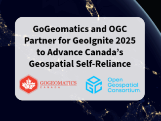
BIM
Canadian BIM and Digital Twin Digest for July 28th, 2022
BIM Contracting and Infrastructure Digital Twins Businesses can improve on operating infrastructure assets by changing the way they use BIM…
Cansel Discusses Innovations in LiDAR: Latest Technologies Across Industries
On April 5, 2022, LiDAR COMEX 2022 held a live stream presentation by Cansel. The topic of “Scan to BIM…
Canadian BIM and Digital Twin Digest for June 29th, 2022
Canadian BIM and Digital Twin Digest: Digital Twinning in Construction; Evolution in Planning Tools with Construction 4.0; BIM Contributes to…
DGT Combines Traditional and Advanced Technologies to advance Unground Mapping
Best practices come from using radar tomography to augment underground utility locating. SUMSF live stream on March 23, 2022, treated…
The Canadian Firm Accelerating the Creation and Use of 3D Reality Models
Traditional pathways for creating, using, and sharing modeled 3D reality data presents challenges to broader adoption. Montreal-based Prevu3D provides a…
Call For Participation: OGC Geotech Interoperability Experiment
The Geotech IE will ensure that geotechnical engineering data can seamlessly move between GIS and BIM environments in support of…
Project Anywhere – Cesium collaboration with Unreal Engine, Microsoft and NVIDIA
Cesium started off in 2011, with a team of developers at an aerospace software company to create an application to…
International Geospatial Briefing for November 2nd: Scottish Geospatial Network Integrator; Tracking Banana diseases using aerial imagery; Lidar data for faster building engineering and architecture; China’s 31st launch of 2020
New support to grow Scottish geospatial sector Although Scotland location-based sector is thriving, Scottish Enterprise’s research has revealed that further…
GeoIgnite 2020 Tracks, Summits, and Forums Announced
I’m thrilled to announce our first tracks, forums and summits for GeoIgnite 2020. A big thank our GeoIgnite conference committee…
Your International Geospatial Briefing for January 13th: US Restricts Export of AI Related to Geospatial Imagery; Momentum Grows During Preparation for Geo Connect Asia 2020; UofG Students Killed in Iranian Plane Tragedy; BIM: How Important Is It For General Contractors?; Elements for improving underground utility mapping to reduce risk of damage during construction
US Restricts Export of AI Related to Geospatial Imagery On January 3rd 2020, the U.S. Bureau of Industry and Security announced…
GeoIgnite 2020 is a GO!
Canada’s highly successful national geospatial event, GEOIGNITE, will be held June 22nd to June 24th, 2020 at the Ottawa Conference and Event…
Plex.Earth Timeviews™ empowers AEC professionals with the latest satellite imagery within AutoCAD
Plexscape, developers of Plex.Earth®, one of the most popular tools for AutoCAD for the acceleration of architectural, engineering and construction…