Community
Flood Mapping and Community Concerns: A Canadian Perspective
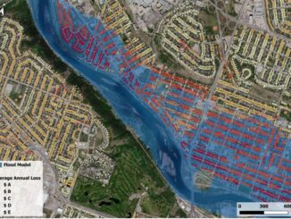
Summerside’s city council has voted against a proposed bylaw change that would have designated parts of the community as flood plain and coastal overlay zones. The decision followed a well-attended council meeting that drew about […]