BIM & GIS
Mapping a More Resilient Future: A Look at Quebec’s New Generation of Floods Maps
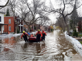
Over the past several years Quebec has been impacted by multiple severe flood events. In 2017 and 2019 much of southern Quebec was flooded and thousands of people were forced to leave their homes. More […]