• facebook
  • Twitter
  • Linkedin
  • Youtube
  • Linkedin Group
  • Post a Job
  • Post an Ad
  • Post an Event
  • Post a Directory Listing
  • Post a Press Release
  • Media Kit
  • My Account
  • Login
GoGeomatics
  • MAGAZINE
    • BIM & GIS
    • Community
    • Conference news
    • Earth Observation
    • Education & Careers
    • GEOAI
    • Announcements
    • Reality Capture & Lidar
    • Science
    • Technology
  • Directories
    • ASSOCIATION
    • INDUSTRY
    • EDUCATION
    • Open Data
  • EVENTS
    • GeoIgnite Events
    • Events Calendar
    • GoGeomatics Meetups
  • Services
    • Advertising
    • Marketing
    • Post a Job
    • Post an Ad
    • Post an Event
    • Post a Press Release
    • Post a Directory Listing
    • Media Kit
    • Web Design
  • Find a Job
  • Volunteer
    • Start a GoGeomatics Group
    • Editors & Writers Group
  • About Us
    • About Us
    • Contact Us
    • Frequently Asked Questions
  • Videos
Homecoastline

coastline

Manon
Conference news

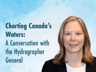
Canada’s Hydrospatial Future: Manon Larocque on Innovation, Collaboration, and the Power of Data

20 May 2025 GoGeomatics Canada | AI

The ocean is still mostly unmapped. Canada’s coastline is the longest in the world. And the future of maritime safety, trade, climate monitoring, and Indigenous collaboration rests on how we fill those gaps — not […]

International Digest April 21||||
Community

International Geospatial Digest – April 21, 2025

21 April 2025 Volunteer Editors and Group Writers | AI

Meet Biomass, the Satellite Measuring the Carbon Content of Rainforests Google and AI – Geospatial Reasoning Mapping Seagrass Along the Italian Coast with Airborne Lidar Bathymetry Idea to Capture Vanguard-1, a Satellite from 1958 Senegal […]

Community

Charting Canada’s Waters: A Conversation with the Hydrographer General

17 February 2025 Kruti Mehta | AI

Hydrography is a cornerstone of safe and efficient navigation in Canada’s vast and complex waterways. From charting the world’s longest coastline to adhering to international maritime standards, the Canadian Hydrographic Service (CHS) ensures maritime safety […]

Events

Notice
There are no upcoming events.

View All Events

Services

  • Post a Job
  • Post an Ad
  • Post an Event
  • Post a Directory Listing
  • Post a Press Release
  • Media Kit
  • My Account
  • Login

Jobs

Post a Job
  • Canada Maps and Poster Gallery Volunteer Leads — GeoIgnite 2026
    remote
  • GIS & Data Analytics Lead
    Beaumont, AB
  • Lead Surveyor, Projects/Arpenteur-géomètre principal, projets; arpenteuse-géomètre principale, projets
    North Bay, Thunder Bay
  • Senior GIS Developer
    Calgary, AB
View All Jobs
  • Directories
    • Associations Directory
    • Industry Directory
    • Education Programs
    • Open Data
  • Volunteer
    • Start a GoGeomatics Group
    • Editors & Writers Group
  • About Us
    • GoGeomatics Media Kit
    • Who We Are
    • Contact Us
    • FAQ’s
    • Advertising
    • Marketing
  • Subscribe
GoGeomatics
GoGeomatics is the largest and most popular communications hub promoting the Canadian geospatial community. The business was incorporated in 2011. GoGeomatics hosts over 100 fun, free, location technology networking events each year in cities across Canada.

© 2025 GoGeomatics

  • facebook
  • Twitter
  • Linkedin
  • Youtube
  • Linkedin Group